
Municipality Beijing Postal code 101200 Local time Monday 1:06 PM | Time zone China Standard (UTC+8) Area code(s) 0010 Population 422,000 (2013) | |
 | ||
Country People's Republic of China Township-level divisions 2 subdistricts
15 towns
1 township Weather 12°C, Wind E at 10 km/h, 46% Humidity Points of interest Mount Pan, Jingdong Grand Valley, Jingdong Stone Forest Go, Jinhaihu Tourism Area, Jingdong Great Dissolvin | ||
Senior nursing home in pinggu district beijing
Pinggu District (simplified Chinese: 平谷区; traditional Chinese: 平谷區; pinyin: Pínggǔ Qū), formerly Pinggu County (平谷县), lies at the extreme eastern end of Beijing Municipality, and borders Tianjin's Ji County. It has an area of 950 square kilometres (370 sq mi) and a population of 396,701 (2000 Census). The district is subdivided into 2 subdistricts, 14 towns, and 2 townships.
Contents
- Senior nursing home in pinggu district beijing
- Map of Pinggu Beijing China
- Administrative divisions
- Overview
- Sister cities
- References
Map of Pinggu, Beijing, China
Administrative divisions
There are 2 subdistricts, 14 towns with 4 towns of which carry the "area" (地区) label, and 2 townships in the district:
Overview
The urban area of Pinggu (90,457 in township) has an estimated area from the Google Earth image of 11.5 km2 (4.4 sq mi) and an estimated population of 70,000.[1]
As of August, 2004, it is the only district or county not linked by an expressway, either existing or under construction. However, plans reveal that an expressway to Pinggu and ultimately to Tianjin (the projected Jingping Expressway) may be coming soon. (More on this in Expressways of Beijing).
Pinggu District was formerly Pinggu County until 2001.
Its postal code number is 101200.
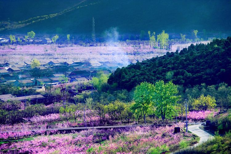
Pinggu district prides itself on the cultivation of the peach.