
Highways US 285 Local time Sunday 9:07 PM | Time zone MST (UTC-7) Elevation 2,575 m | |
 | ||
Weather 11°C, Wind W at 16 km/h, 24% Humidity | ||
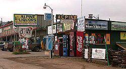
Full auto 14 july 13 pine junction colorado
Pine Junction is a small unincorporated community in central Colorado in the United States. Pine Junction is the first intersection with a traffic light on U.S. Highway 285 in the foothills. At this traffic light, you can turn left on Colorado Rd 126 to go to the historic Town of Pine Grove and continue to State Highway 67 to Deckers and Woodland Park.
Contents
- Full auto 14 july 13 pine junction colorado
- Map of Pine Junction Pine Junction Area CO 80470 USA
- Pikes peak from pine junction colorado
- References
Map of Pine Junction, Pine Junction Area, CO 80470, USA
Pine Junction is situated in the foothills of the Front Range south of Mount Evans, approximately 25 miles (40 km) southwest of Denver along U.S. Highway 285. The community sits astride the Park-Jefferson county line, and is situated at the crest of a hill on the highway, east of where the highway drops from Crow Hill down into the Platte Canyon near Bailey. The community consists of a strip of retail businesses along the highway, as well as nearby houses on either side of highway. It serves partially as a bedroom community for the Denver Metropolitan Area to the northeast.