
Country United States County Vigo Time zone Eastern (EST) (UTC-5) Elevation 183 m Local time Sunday 8:36 PM | State Indiana Area code(s) 812 Zip code 47802 | |
 | ||
Weather 11°C, Wind S at 11 km/h, 51% Humidity | ||
Pimento is an unincorporated community in Linton Township, Vigo County, in the U.S. state of Indiana. It is part of the Terre Haute Metropolitan Statistical Area.
Contents
Map of Pimento, IN 47866, USA
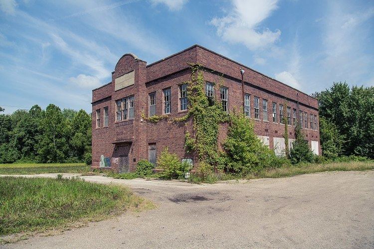
Pimento has one listing on the National Register of Historic Places, the Linton Township High School and Community Building.
History
Formerly known as Hartford, Pimento was laid out in 1852 by Israel French. The name was changed to Pimento when it became a railroad station on the Evansville & Terre Haute Railroad. Thomas French made the first location in the place and put up a store. The next year came Harvey Weeks, who became a partner in the store. N. B. Bennett began a drug store in 1865, and then a grocery store. A large flour mill was built in 1877, and a tavern, large dry goods store and blacksmith shop soon followed. A town-house was erected in 1858 and the lower part used as a school house.
The Pimento post office has been in operation since 1855.
Geography
Pimento is located at 39°18′34″N 87°22′45″W.