
 | ||
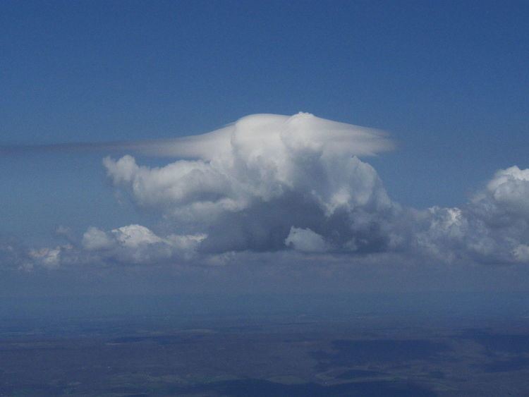
A pileus (/ˈpaɪliː.əs/; Latin for cap), also called scarf cloud or cap cloud, is a small, horizontal, lenticular cloud that can appear above a cumulus or cumulonimbus cloud, giving the parent cloud a characteristic "hoodlike" appearance. Pilei tend to change shape rapidly. They are formed by strong updraft at lower altitudes, acting upon moist air above, causing the air to cool to its dew point. As such, they are usually indicators of severe weather, and a pileus found atop a cumulus cloud often foreshadows transformation into a cumulonimbus cloud, as it indicates a strong updraft within the cloud.
Clouds that are attached to pilei are often given the suffix "pileus" or "with pileus". For example, a cumulonimbus cloud with a pileus attached to it would be called "cumulonimbus with pileus".
Pilei can also form above ash clouds and pyrocumulus clouds from erupting volcanoes (see the adjacent image).
Pilei form above some mushroom clouds of high-yield nuclear detonations.
A sheet of altostratus cloud often is seen lower down in a cumulonimbus cloud, this is known as a velum cloud.
Forecast
Pilei clouds indicate that the parent cloud is growing rapidly, has plenty of moisture, and is highly unstable. This means that the parent cloud could quickly grow to become a cumulonimbus cloud and continue to grow into a cumulonimbus incus cloud. These clouds can cause severe weather and sightings of pilei should be viewed as a warning of an impending storm. Pilei also indicate strong and possibly damaging winds.