Precipitation cloud? Sometimes Classification Family B (mid-level) | Indicates precipitation Light rain or snow. Abbreviation Ac len | |
 | ||
Altitude up to 12,000 m(up to 40,000 ft) Appearance lens-like, Saucer-shaped | ||
June 2015 what are lenticular clouds
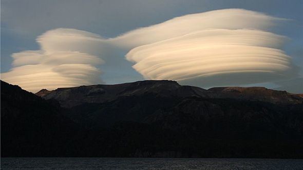
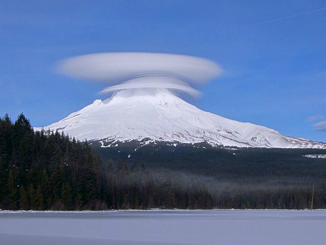
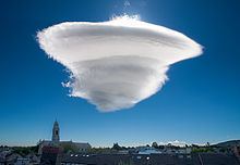
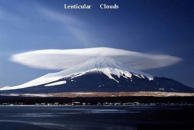
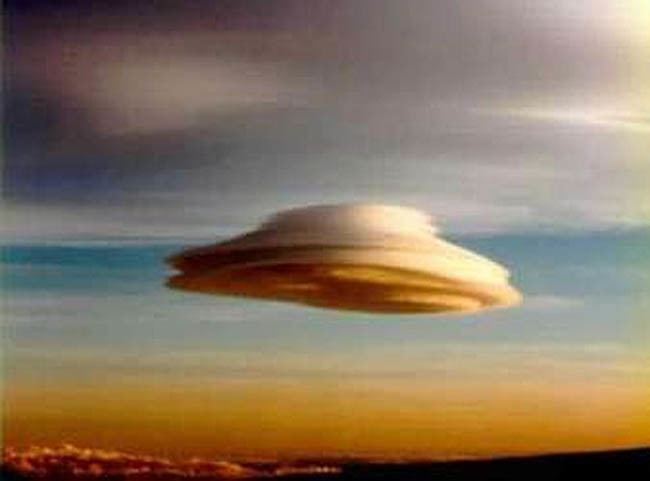
Lenticular clouds (Altocumulus lenticularis) are stationary lens-shaped clouds that form in the troposphere, normally in perpendicular alignment to the wind direction. Lenticular clouds can be separated into altocumulus standing lenticularis (ACSL), stratocumulus standing lenticular (SCSL), and cirrocumulus standing lenticular (CCSL). Because of their shape, they have been offered as an explanation for some unidentified flying object (UFO) sightings.
Contents
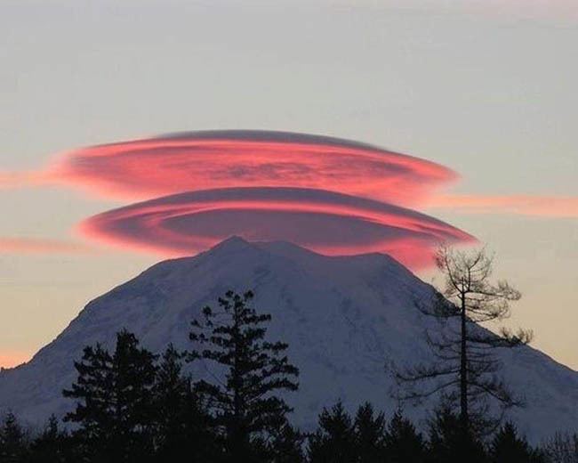
Lenticular clouds over mt rainier
Formation
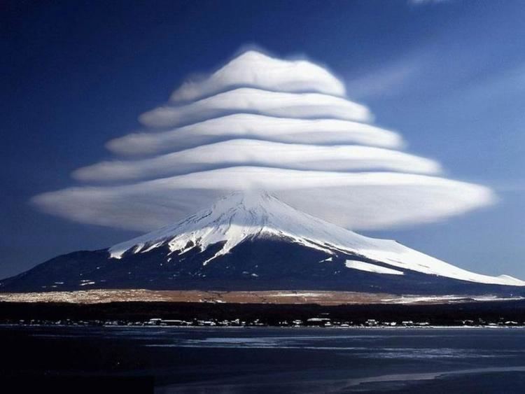
As air flows along the surface of the Earth, it encounters obstructions. These are human-made objects, such as buildings and bridges, and natural features, like hills, valleys, and mountains. All of them disrupt the flow of air into eddies. The strength of the eddies depends on the size of the object and the speed of the wind. It results in turbulence classified as ‘mechanical’ because it is formed through the “mechanical disruption of the ambient wind flow”. Where stable moist air flows over a mountain or a range of mountains, a series of large-scale standing waves may form on the downwind side. If the temperature at the crest of the wave drops to the dew point, moisture in the air may condense to form lenticular clouds. As the moist air moves back down into the trough of the wave, the cloud may evaporate back into vapour. Under certain conditions, long strings of lenticular clouds can form near the crest of each successive wave, creating a formation known as a "wave cloud." The wave systems cause large vertical air movement, enough that water vapour may condense to produce precipitation. The clouds have been mistaken for UFOs (or "visual cover" for UFOs), particularly the round "flying saucer"-type, because these clouds have a characteristic lens appearance and smooth saucer-like shape; also, because lenticular clouds generally do not form over low-lying or flat terrain, many people have never seen one and are not aware clouds with that shape can exist. Bright colours (called irisation) are sometimes seen along the edge of lenticular clouds. These clouds have also been known to form in cases where a mountain does not exist, but rather as the result of shear winds created by a front.
Flight
Pilots of powered aircraft tend to avoid flying near lenticular clouds because of the turbulence of the rotor systems that accompany them, but glider pilots actively seek them out. The precise location of the rising air mass is fairly easy to predict from the orientation of the clouds. "Wave lift" of this kind is often very smooth and strong, and enables gliders to soar to remarkable altitudes and to great distances. As of 2016 the gliding world records for both distance (over 3,000 km; 1,864 mi) and absolute altitude (15,460 m; 50,721 ft) were set using such lift.