
Area 439 km² | ||
 | ||
Administrative divisions 1 ŭp, 2 workers' districts, 21 ri | ||
P'ihyŏn County is a kun, or county, in northwestern North P'yŏngan province, North Korea. It is bounded to the north by Ŭiju, to the east by Ch'ŏnma, to the south by Yŏmju and Tongrim, and to the west by Ryongch'ŏn and the large city of Sinŭiju. It was established as a separate county in 1952, and was subsequently reorganized in 1954, 1958, 1961, 1963, 1967 and 1978.
Contents
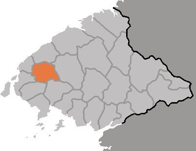
Map of Pihyon, North Korea
Geography
The land of P'ihyŏn is generally flat in the west, rolling in the center, and rises to the low Munsu Mountains in the east. The chief of these peaks is Munsusan (문수산, 736 m). The chief local stream is the Samgyoch'ŏn (삼교천), a tributary of the Yalu River. Forestland covers 57% of the county's area (of that, pine forests account for 80%); 31% of the county is cultivated.
Administrative Divisions
P'ihyŏn is divided into 1 ŭp (town), 2 rodongjagu (workers' districts) and 21 ri (villages):
Climate
The year-round average temperature is 8.5 °C, dipping to a January mean of -9.5 °C and rising to 23.6 °C in August. The annual rainfall averages 1065 mm.
Economy
Crops raised on that cultivated land include rice, maize, soybeans, and sweet potatoes. Peanuts are also raised; Pihyon ranks second in the province in peanut production, and third in sheep production. The county is known for its hogs.
P'ihyŏn is home to the P'ihyŏn College of Land Administration.
Transportation
The P'yŏngŭi (P'yŏngyang-Sinŭiju) and Paengma (Yŏmju-South Sinŭiju) lines of the Korean State Railway pass through the county.