
Elevation 55 m | ||
 | ||
Volcanic arc/belt Auckland volcanic field | ||
Pigeon mountain new zealand top 12 facts
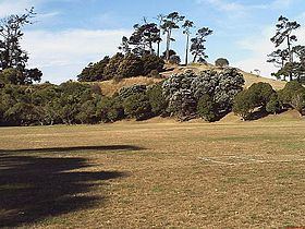
Ōhuiarangi / Pigeon Mountain is a 55 m (180 ft) high volcanic cone at Half Moon Bay, near Howick and Bucklands Beach, in Auckland, New Zealand. The cone forms the last part of volcanic activity that lasted many years. An earlier explosive eruption, created the prominent tuff ring that is still clearly visible extending in an arc south of Sunderlands Road. Two much smaller craters were formed to the north west of the main cone. The smaller lies buried under Pigeon Mountain Road outside number 18, and the other forms 'Heights Park' - a private reserve for the owners of 29 - 41 Pigeon Mountain Road and 14 - 36 Prince Regent Drive and 33 - 39 Tyrian Close. It forms part of the Auckland volcanic field and is popular for scientific school trips. It was first quarried for roading metal by fencibles from the 1847 fencibles settlement at Howick. Quarrying continued for many years. In the 1920s the Shaw brothers worked with Harold Kearney, Dud Langdon and Jim Taylor using a pair of draught horses to pull a dray loaded with metal. In 1848 John Campbell and James Smyth both from the fencible ship Sir Robert Sale, had the contract to spread metal on the road from Howick to Panmure, for which they were paid 5/-per day. At that time the mountain was named Pigeon Tree Hill.
The 5 acre farm immediately to the south was owned by the 1847 Irish Fitzpatrick family of Patrick and Ann who came in the "Minerva" fencible ship. They lived in a raupo hut at Howick for 2 years. They had had 12 children,9 of whom survived. The children all attended Pakuranga school, a short distance across the paddocks to the south east. Fitzpatrick later bought other land around Ōhuiarangi / Pigeon Mountain at Hutchinson Road and Bucklands Beach Rd expanding his farm to 20 acres. A photo taken of the Pakuranga Cricket club, which played at Ōhuiarangi / Pigeon Mountain, shows 6 of the 16 players were from the Fitzpatrick family. His original fencibles cottage was still in use in the 1960s by 2 of his grandsons who were the caretakers of the Ōhuiarangi / Pigeon Mountain sports ground in their youth. On their death the cottage was placed at the Howick Historical village. A number of fencibles' widows also received land south of Ōhuiarangi / Pigeon Mountain which was very swampy. Margaret Coyle received 4 acres of land where Pakuranga College is today. The mountain has been extensively quarried, with the entire north side of the volcano removed.
In 1929 a fresh water spring was uncovered and water was piped to Howick and district at a cost of 9340 pounds. The mountain is a former pa site, and some of the terracing still remains. Artefacts as well as skulls were found there in the 1960s by students from Pakuranga College. The mountain is open to the public. The north face is partly fenced off and is an almost-vertical drop of 30 metres (100 ft).
In the southwest corner there is a playing field built on a free-draining scoria base. On the quarried northwestern side is a kindergarten and Scout hall.
In the 2014 Treaty of Waitangi settlement with the Tamaki Makaurau Collective of 13 Auckland iwi, the volcano was officially named Ōhuiarangi / Pigeon Mountain and ownership was vested to the collective. It is now co-governed by the collective and Auckland Council in common benefit of the iwi "and all other people of Auckland".