
Traversed by OR 31 Range Cascade Range | Elevation 1,411 m | |
 | ||
Location | ||
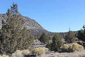
Picture Rock Pass, elevation 4,830 feet (1,470 m), is a mountain pass in Oregon traversed by Oregon Route 31. It is located between the communities of Silver Lake and Paisley in Lake County. Geographically, it separates Silver Lake and Summer Lake. These two lakes with their related drainage basins are the most northwesterly part of the Great Basin.
Map of Picture Rock Pass, Oregon 97640, USA
The name of the pass comes from petroglyphs on rocks south of the highway at the Picture Rock Pass Petroglyphs Site.
References
Picture Rock Pass Wikipedia(Text) CC BY-SA