
Local time Friday 10:08 AM | ||
 | ||
Weather 24°C, Wind NE at 24 km/h, 64% Humidity Civil parish São Salvador do Mundo, Cape Verde | ||
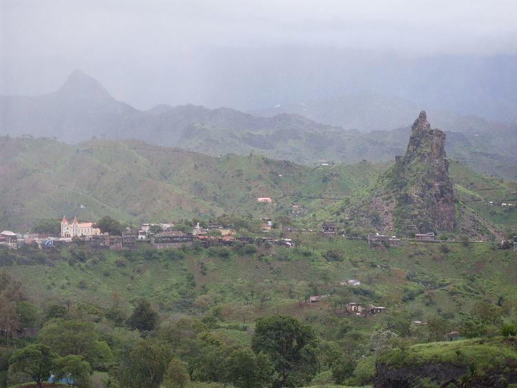
Picos, also known as Achada Igreja, is a town in the central part of the island of Santiago, Cape Verde. It is the capital of São Salvador do Mundo municipality. Picos is located 23 km northwest of the capital city of Praia, on the main road from Praia to Tarrafal via Assomada. Its name etymology are that several short and tall peaks and rock formation dominate the area, the main peak is not far in the north elevating 491 meters above sea level and around 400,000 to 200,000 years ago, it was a little taller and was a volcanic plug to the nearby mountains around Pico da Antónia. It was around 600 meters during the Ice Age. Nearby is the settlement of Faveta (probably the main name of Manipulo).
Contents
Map of Picos, Cape Verde
The natural park of Pico da Antónia is situated south of the town. It is also the east of the parish of São Salvador do Mundo and has its church.
The football (soccer) club of União de Picos is based in the town, it is also the club of the municipality which is also a parish, they have a football (soccer) field but the club plays in Assomada at Estádio de Cumbém.
The area of Casa Grande was once the municipal seat of Santa Catarina in 1845 and between 1851 and 1857.
History
On February 14, 1834 Portuguese colonial governor Manuel António Martins decided to transfer the colonial seat from Ribeira Grande (now Cidade Velha) to Picos.
It was a famine-stricken area in 1855 as was the rest of the island, the governor temporarily moved the residence to Picos, not Praia.