
Listing Ultra Mountain type Stratovolcano Elevation 4,784 m Prominence 1,652 m Mountain range Andes | Parent range Andes Volcanic arc/belt North Volcanic Zone Last eruption 2002 First ascender Alexander von Humboldt Age of rock Pleistocene | |
 | ||
Similar Cayambe, Illiniza, Cotopaxi, Antisana, Chimborazo | ||
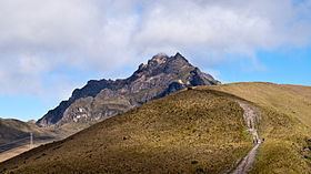
Ecuador pichincha volcano panoramic view
Pichincha is an active stratovolcano in the country of Ecuador, whose capital Quito wraps around its eastern slopes. The two highest peaks of the mountain are Wawa Pichincha (Kichwa wawa child, baby / small, Hispanicized spelling Guagua Pichincha) (4,784 metres (15,696 ft)) and Ruku Pichincha (Kichwa ruku old person, Hispanicized Rucu Pichincha) (4,698 metres (15,413 ft)). The active caldera is in Wawa Pichincha on the western side of the mountain.
Contents
- Ecuador pichincha volcano panoramic view
- Map of Pichincha Volcano Ecuador
- Climbing rucu pichincha volcano next to quito
- References
Map of Pichincha Volcano, Ecuador
Both peaks are visible from the city of Quito and both are popular acclimatization climbs. Wawa Pichincha is usually accessed from the village of Lloa outside of Quito. Ruku is typically accessed from the TelefériQo on the western side of Quito. In October 1999, the volcano erupted and covered the city with several inches of ash. Prior to that, the last major eruptions were in 1553 and in 1660, when about 30 cm of ash fell on the city.
The province in which it is located takes its name from the mountain, as is the case for many of the other provinces in Ecuador (Cotopaxi, Chimborazo, Imbabura, etc.). On May 24, 1822, General Sucre southern campaign in the context of the Spanish-America war of independence, came to a climax when patriot forces defeated the Spanish colonial army on the south-east slopes of this volcano. The engagement, known as the Battle of Pichincha, secured the independence of the territories of present-day Ecuador.