
Easiest route From Refuge de Goriz First ascent 24 September 1865 | Elevation 3,248 m | |
 | ||
Similar Monte Perdido, Pic du Taillon, Cilindro de Marboré, Grand Astazou, Tour du Marboré | ||
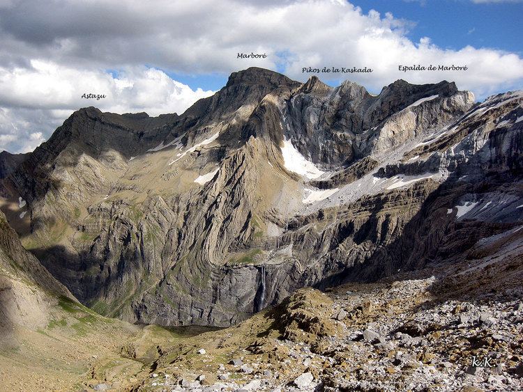
Marboré Peak (Pic de Marboré, El Marboré) is a summit in the Pyrenees located on the Franco-Spanish border crest in the Monte Perdido Range.
Contents
Map of Pic de Marbor%C3%A9, 22375, Huesca, Spain
TopographyEdit
Marboré Peak is one of the peaks above Cirque de Gavarnie. It marks the border between the Pyrenees National Park (France) and the Ordesa y Monte Perdido National Park (Spain).
HistoryEdit
Philippe de Nemours in 1846 was perhaps the first to have climbed Marboré Peak, though we lack precision to attribute it to him.
References
Pic de Marboré Wikipedia(Text) CC BY-SA