Car plates PP | Area 1,267 km² Team PTPS Piła | |
 | ||
Gminas Total 9 (incl. 1 urban)PiłaGmina BiałośliwieGmina KaczoryGmina ŁobżenicaGmina Miasteczko KrajeńskieGmina SzydłowoGmina UjścieGmina WyrzyskGmina Wysoka Points of interest Rezerwat przyrody Kuźnik, Park na Wyspie w Pile, Muzeum Okręgowe im Stanis, Park Miejski im Stanisław, Muzeum Stanisława Staszica | ||
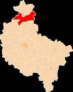
Piła County (Polish: powiat pilski) is a unit of territorial administration and local government (powiat) in Greater Poland Voivodeship, west-central Poland. It came into being on January 1, 1999, as a result of the Polish local government reforms passed in 1998. Its administrative seat and largest town is Piła, which lies 85 kilometres (53 mi) north of the regional capital Poznań. The county contains four other towns: Wyrzysk, 36 km (22 mi) east of Piła, Ujście, 10 km (6 mi) south of Piła, Łobżenica, 37 km (23 mi) east of Piła, and Wysoka, 25 km (16 mi) east of Piła.
Contents
Map of Pi%C5%82a County, Poland
The county covers an area of 1,267.1 square kilometres (489.2 sq mi). As of 2006 its total population is 137,099, out of which the population of Piła is 75,044, that of Wyrzysk is 5,234, that of Ujście is 3,899, that of Łobżenica is 3,172, that of Wysoka is 2,750, and the rural population is 47,000.
Neighbouring counties
Piła County is bordered by Złotów County to the north, Sępólno County and Nakło County to the east, Wągrowiec County to the south-east, Chodzież County and Czarnków-Trzcianka County to the south, and Wałcz County to the north-west.
Administrative division
The county is subdivided into nine gminas (one urban, four urban-rural and four rural). These are listed in the following table, in descending order of population.
