
Country Thailand Time zone THA (UTC+7) Area 359.5 km² Geocode 3028 | Seat Sa Phra Postal code 30220 Population 44,232 (2000) | |
 | ||
Province Nakhon Ratchasima Province | ||
Phra Thong Kham (Thai: พระทองคำ) is a district (amphoe) in the northern part of Nakhon Ratchasima Province, northeastern Thailand.
Contents
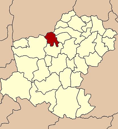
- Map of Phra Thong Kham District Nakhon Ratchasima Thailand
- History
- Etymology
- Geography
- Administration
- References
Map of Phra Thong Kham District, Nakhon Ratchasima, Thailand
History
Tambon Sa Phra, Thap Rang, Phang Thiam, Nong Hoi and Map Krat were separated from Non Thai district to create the Phra Thong Kham minor district on July 15, 1996.
Following a decision of the Thai government on May 15, 2007, all of the 81 minor districts were upgraded to full districts. With the publishing in the Royal Gazette on August 24 the upgrade became official.
Etymology
Phra Thong Kham in Thai language means Golden Lord Buddha image. The name Phra Thong Kham has two origins
- The center of the minor district was located in Ban Pa Kham, Tambon Sa Phra. The people selected the last words from the location name and add Thong as a middle word for good meaning.
- Phraya Palat Thong Kham was the husband of Thao Suranaree, the heroine of Nakhon Ratchasima.
Geography
Neighboring districts are (from the north clockwise) Chatturat and Noen Sa-nga of Chaiyaphum Province, Khong, Kham Sakaesaeng, Non Thai and Dan Khun Thot of Nakhon Ratchasima Province.
Administration
The district is subdivided into 5 subdistricts (tambon). The township (thesaban tambon) Phra Thong Kham covers parts of the tambon Sa Phra.