
Location Bidasoa Region Aquitaine Autonomous community Basque Country Area 6,820 m² Province Gipuzkoa | Highest elevation 6 m (20 ft) Département Pyrénées-Atlantiques Population 0 Elevation 6 m | |
 | ||
Similar Bidasoa, Bay of Txingudi, Perejil Island, Château d'Abbadie, Musée Basque | ||
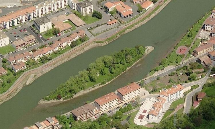
Pheasant Island (Spanish: Isla de los Faisanes, French: Île des Faisans, Basque: Konpantzia) is a river island in the Bidasoa river.
Contents
Map of Pheasant Island
GeographyEdit
The island is a condominium established by the Treaty of the Pyrenees in 1659, under joint sovereignty of Spain and France, and is administered by Irun (in Gipuzkoa, Spain) and Hendaye (in the Pyrénées-Atlantiques, France), which have sovereignty on the island for alternating periods of six months. The island has an area of 6,820 square metres (73,410 square feet) and has been artificially protected from the currents of the river.
EtymologyEdit
In French, the island is also known as Île de l’hôpital and Île de la Conférence.
HistoryEdit
The most important historical event that took place on the island was the meeting place for the signing of the Treaty of the Pyrenees. It was the climax to a series of 24 conferences held between Luis de Haro, a Grandee of Spain and Chief minister of France, Cardinal Mazarin in 1659 following the end of the Thirty Years' War. A monolith was built in the centre of the island to commemorate the meeting.
The island has also been used for several other royal meetings:
AccessEdit
No visitors are allowed on the island.