
Country Thailand Time zone THA (UTC+7) Area 1,017 km² Province Chumphon Province | Seat Phato Postal code 86180 Population 22,633 (2008) Geocode 8606 | |
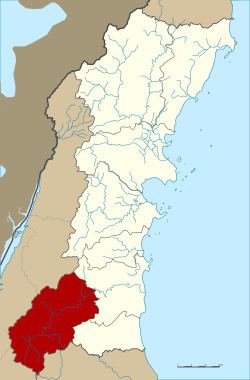 | ||
Phato (Thai: พะโต๊ะ, [pʰā.tóʔ]) is a district (Amphoe) of Chumphon Province, southern Thailand.
Contents
Map of Phato District, Chumphon 86180, Thailand
History
Originally Patho was a district of Mueang Lang Suan, which was abolished and included into Chumphon province in 1932. In 1938 Phato was reduced to a minor district (King Amphoe). On June 19, 1991 it was upgraded to a full district.
Geography
Neighboring districts are (from the east clockwise) Lang Suan and Lamae of Chumphon province, Tha Chana and Chaiya of Surat Thani Province, Kapoe, Mueang Ranong and La-un of Ranong Province.
Within the Kuan Mae Yai Mon Wildlife Sanctuary in the southwest of the district is the Heo Lom waterfall, one of the attractions of the district. The terrain is mostly mountainous with several small rivers, which make it a popular place for rafting.
Symbols
The slogan of the district is Green hills, go rafting, see fog cover, beautiful waterfall, famous for fruits.
Administration
The district is subdivided into 4 subdistricts (tambon), which are further subdivided into 43 villages (muban). The subdistrict municipality (thesaban tambon) Phato covers part of the tambon Phato, the subdistrict municipality Pak Song the whole same-named subdistrict. There are further 3 Tambon administrative organizations.