
Country Vietnam Time zone UTC + 7 (UTC+7) Local time Friday 10:00 AM | Capital Cái Đôi Vàm Area 426 km² Province Ca Mau Province | |
 | ||
Weather 28°C, Wind E at 19 km/h, 82% Humidity | ||
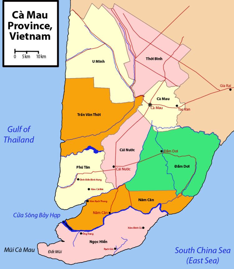
Phú Tân is a rural district of Cà Mau Province in the Mekong Delta region of Vietnam. As of 2003 the district had a population of 111,791. The district covers an area of 426 km². The district capital lies at Cái Đôi Vàm.
Contents
Map of Ph%C3%BA T%C3%A2n District, Ca Mau, Vietnam
Phu Tan was created the government decree No 138/2003/NĐ-CP on November 17, 2003, after being split off from Cái Nước District. Phu Tan borders Cái Nước District to the east; ocean to the west, Năm Căn District to the south and Trần Văn Thời District to the north. At the time of its creation, it spanned 446 km² and had a population of 109,642.
Divisions
The district is divided into communes:
Cái Đôi Vàm, Phú Mỹ, Phú Tân, Tân Hải, Việt Thắng, Tân Hưng Tây, Nguyễn Việt Khái
References
Phú Tân District, Cà Mau Wikipedia(Text) CC BY-SA