
Postal code 01100 | ||
 | ||
Weather 27°C, Wind S at 11 km/h, 93% Humidity Restaurants Hotel Bankshall, Ariya Cafe, Ari Cafe, Norris Hotel And Bakery, Beema Hotel | ||
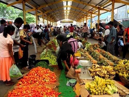
Pettah is a neighborhood in Colombo, Sri Lanka located east of the City centre Fort. The Pettah neighborhood is famous for the Pettah Market, a series of open air bazaars and markets. It is Sri Lanka's most busiest commercial area, where most of the shops, textiles, buildings and many other business organizations are centered.
Contents
Map of Pettah, Colombo, Sri Lanka
Pettah is derived from the Tamil word, Pettai, an Anglo-Indian word used to indicate a suburb outside a fort. Today, the Sinhalese phrase, pita-kotuwa (outside the fort) conveniently describes the same place.
Demographics
Pettah is a multi-religious and multi-ethnic area. Moors and Memons are the predominant ethnic group found within Pettah, however an average amount of Sinhalese and Tamil populations also exist. There are also various other minorities such as Burghers, Malays and others. Religions include Buddhism, Hinduism, Islam, Christianity and various other religions and beliefs to a lesser extent.
Buildings and landmarks
Notable landmarks in the neighborhood include Wolvendaal Church, the Jami Ul-Alfar Mosque, Kayman's Gate, the old Colombo Town Hall, the Colombo Dutch Museum and the Khan Clock Tower, which was built by the Khan family of Bombay (now known as the city of Mumbai) in India.