
Population 846 (Parish-2011) Sovereign state United Kingdom Area 6.5 km² District Rother | OS grid reference TQ873139 Post town HASTINGS Local time Wednesday 3:47 PM Dialling code 01424 | |
 | ||
Weather 12°C, Wind SW at 16 km/h, 83% Humidity | ||
Winchelsea pett level in east sussex british shore fishing locations south east coast england
Pett is a village and civil parish in the Rother District of East Sussex, England. The village is located 5 miles (8.0 km) north-east of Hastings on the edge of Pett Level, the one-time marshes stretching along the coast of Rye Bay.
Contents
- Winchelsea pett level in east sussex british shore fishing locations south east coast england
- Map of Pett UK
- History
- Landmarks
- References
Map of Pett, UK
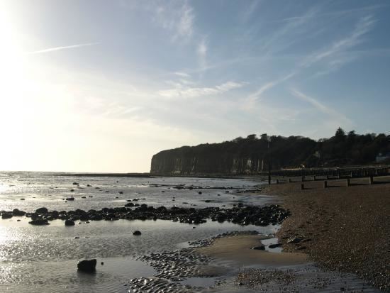
The road through the village leads down to the second village in the parish: Pett Level, the coastal part of which is known as Cliff End. Here there is a beach and, as the name suggests, the Weald sandstone cliffs reach their easternmost point. Pett Level marks the end of both the Royal Military Canal and the western end of the 1940s sea defence wall. The Saxon Shore Way passes through Pett Level.
Pett parish church is dedicated to St Mary and St Peter. Pett also has a Methodist chapel, originally Mount Calvary Bible Christian Chapel, and a small Church of England church at Cliff End.
History
The manor of Pett belonged to a succession of families, including the Halle family, the Levett family, the Fletchers and the Medleys, before eventually passing to the Earls of Liverpool.
Landmarks
There is a Site of Special Scientific Interest partly within the parish. Hastings Cliffs to Pett Beach runs along the coast and is of both biological and geological interest. The cliffs hold many fossils and have many habitats, including ancient woodland and shingle beaches.