
Elevation 720 m (2,360 ft) | Time zone BRT/BRST (UTC-3/-2) | |
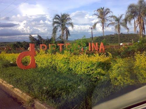 | ||
Petrolina de Goiás is a municipality in central Goiás state, Brazil.
Contents
- Map of Petrolina de GoiC3A1s State of GoiC3A1s Brazil
- Location
- History
- Demographics
- The economy
- Education and Health
- References
Map of Petrolina de Goi%C3%A1s - State of Goi%C3%A1s, Brazil
Location
Petrolina de Goiás is located 81 km. almost due north of Goiânia, the state capital. It is 23 km. southwest of São Francisco de Goiás, 23 km. northwest of Ouro Verde de Goiás, 21 km. north of Damolândia, and 23 km. east of Santa Rosa de Goiás.
Neighboring municipalities: Santa Rosa de Goiás, Jesúpolis, São Francisco de Goiás, and Ouro Verde de Goiás, Pirenópolis, Inhumas and Itauçu.
History
Petrolina de Goiás owes its origin to the fertility of the soils of the basin of the Córrego Descoberto. Joaquim Pedro and his family donated lands to create the settlement and build a chapel to honor Santa Maria Eterna. The first name was "Descoberto" but this was changed to "Petrolina" in honor of the founder, Pedro. In 1932 it became a district in the municipality of Jaraguá. In 1943 the name was changed to "Goialina", only to be changed again in 1948 to Petrolina de Goiás.
Demographics
The economy
The economy is based on agriculture, cattle raising, services, public administration, and small transformation industries.
The cattle herd had 61,800 head in 2007. The main crops cultivated were pineapples, garlic, rice, bananas, manioc, corn, and tomatoes.
Agricultural data 2006
Education and Health
There were 9 schools and 2,560 students in 2006. The adult literacy rate was 82.0% (2000) (the national average was 86.4%). There was one hospital with 23 beds in 2007. The infant mortality rate was 18.74 (2000) (the national average was 33.0).
Ranking on the Municipal Human Development Index
All data are from 2000
For the complete list see Frigoletto.com.br