
Country United States County Allen Time zone Central (CST) (UTC-6) Elevation 290 m Local time Wednesday 8:17 AM | State Kansas Township Logan FIPS code 20-55625 Zip code 66720 Area code 620 | |
 | ||
Weather 12°C, Wind E at 31 km/h, 97% Humidity | ||
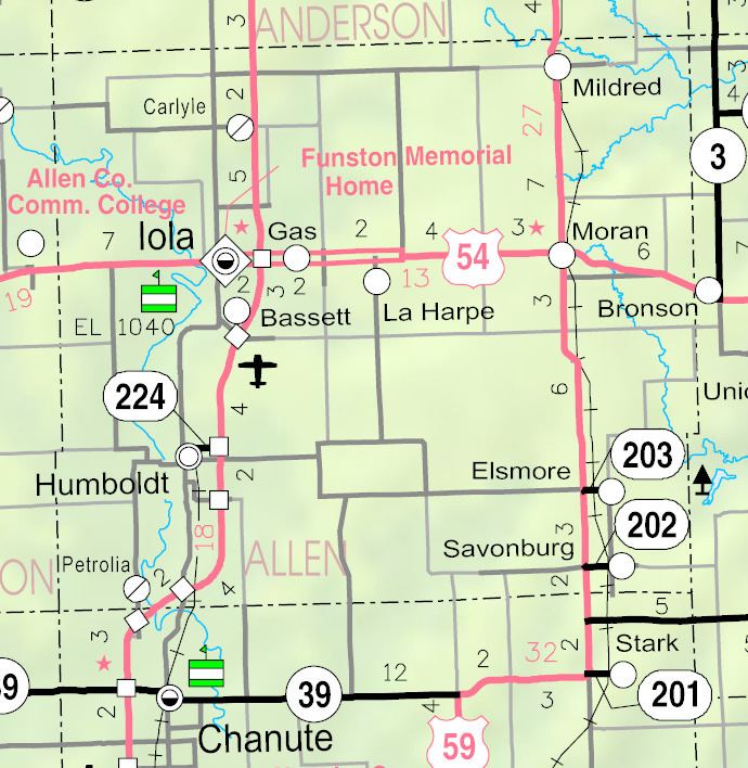
Petrolia is an unincorporated community situated along the Neosho River in the southwestern part of Allen County, located in southeast Kansas, in the central United States of America. Although official populations are not compiled for unincorporated places, the population of the surrounding Logan Township was 225 in the 2000 census.
Contents
Map of Petrolia, KS 66748, USA
History
In 1910, Petrolia had a money order postoffice, an express office, and was a trading point for the neighborhood. The population that year was 200.
Petrolia had a post office from July 1905 until September 1953.
Geography
Petrolia is located at 37°44′45″N 95°28′18″W (37.7458767, -95.4716486), in Sections 31–32, Township 26 south, Range 18 east. Less than a mile from the southern border of Allen County, it is situated west of the Neosho River and to the south of Scatter Creek. Contained entirely within Logan Township, it is about 5 miles south-southwest of Humboldt and 13 miles from Iola (the county seat). U.S. Route 169 crosses the Neosho River a mile to the south of Petrolia.