
Population 1,689 (2006 census) Postcode(s) 5422 Elevation 535 m Local time Tuesday 2:34 PM | Established 1879 Postal code 5422 | |
 | ||
Weather 24°C, Wind SW at 11 km/h, 33% Humidity | ||
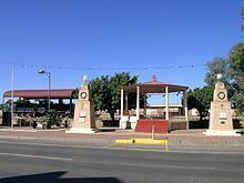
Peterborough is a town in the mid north of South Australia, in wheat country, just off the Barrier Highway. At the 2006 census, Peterborough had a population of 1,689.
Contents
Map of Peterborough SA 5422, Australia
It was originally named Petersburg after the landowner, Peter Doecke, who sold land to create the town. It was one of 69 places in South Australia renamed in 1917 due to anti-German sentiments during World War I.
History
The first settlers in the area purchased land from the government in 1875. The first building in the town was constructed four years later. Settler Peter Doecke transferred his land to J H Koch in 1876, who found out in 1880 that the land would be the site of a railway junction. He subdivided it and sold 33 acres (13 ha) for £1700, after failing to get £500 for it in 1879. By 1880 a hotel and post office had been erected, followed by a school in 1883, and a town hall in 1884. At the prompting of mayor W. Thredgold, a newspaper, the Petersburg Times was founded in 1887 by Robert M. Osborne, became The Times and Northern Advertiser in 1919, under the longterm proprietorship of W. H. Bennett and survived as a family business until 1970.
Heritage listings
Peterborough has a number of heritage-listed sites, including:
Government
Peterborough is the seat of the District Council of Peterborough. It is the largest town in the council area. Peterborough is in the state electorate of Stuart and federal Division of Grey. Peterborough at one point in time had its own town council (Corporation of the Town of Peterborough) surrounded by the district council.
Railways
Peterborough sat on the intersection of the East-West railway linking Port Pirie and Broken Hill, and the North–South railway linking Adelaide eventually to Alice Springs via Quorn, both narrow gauge (1,067 mm (3 ft 6 in)) lines between 1917 (when the Trans-Australian Railway opened across the Nullarbor Plain) and 1937 (when a more direct south-north route bypassed the Peterborough–Quorn railway line by connecting Port Pirie to Port Augusta). The Peterborough railway station is still in operation and is a stop on the weekly Indian Pacific train.
The line from Port Pirie and Jamestown arrived in 1881, followed shortly after by the line from Terowie in the south and north to Quorn. The line to Broken Hill was completed in 1887. Peterborough was the home town for Bob the Railway Dog who is remembered by a bronze statue located in the Main Street.
In 1970, the East-West line was converted to standard gauge (1,435 mm (4 ft 8 1⁄2 in)), and the line south of Peterborough to Terowie to broad gauge (1,600 mm/5 ft 3 in). Thus Peterborough became one of three, triple-gauge railway junctions in Australia. The others being Gladstone and Port Pirie, all on the same railway corridor.
The broad-gauge connection to Adelaide, via Burra, was severed in the late 1980s. The narrow-gauge line north to Quorn last carried freight in 1980, and was removed, between Eurelia and Bruce in the mid-1980s. Grain trains ran as far as Orroroo into the mid 1980s. In its later years it was used by tourist trains from Steamtown as far as Eurelia. Steamtown ceased operations in 2002, however the roundhouse is still used to display its coaches and locomotives. The District Council, with funding from the three tiers of government and recovery of the Eurelia line, have subsequently established the Steamtown Heritage Rail Centre, with SA's first Sound & Light Show.
Education
Peterborough High School was opened in 1927 and caters for students from years 8 to 12.
Peterborough Primary School was opened in 1883 and caters for students from years reception to 7.
St Joseph's School is a reception to Year 7 Catholic primary school which was founded by Mary MacKillop and the Sisters of St Joseph.