
Charter 1868 Municipal tax rate 20% | Time zone EET (UTC+2) Local time Wednesday 6:35 PM | |
 | ||
Area rank 192nd largest in Finland Weather -1°C, Wind NW at 14 km/h, 42% Humidity | ||
Petäjävesi is a municipality of Finland.
Contents
Map of 41900 Pet%C3%A4j%C3%A4vesi, Finland
It is located in the province of Western Finland, next to Jyväskylä and is part of the Central Finland region. The municipality has a population of 3,993 (31 March 2016) and covers an area of 456.41 square kilometres (176.22 sq mi) of which 39.01 km2 (15.06 sq mi) is water. The population density is 8.75 inhabitants per square kilometre (22.7/sq mi).
Neighbouring municipalities are Jyväskylä, Jämsä, Keuruu, Multia and Uurainen.
The municipality is unilingually Finnish.
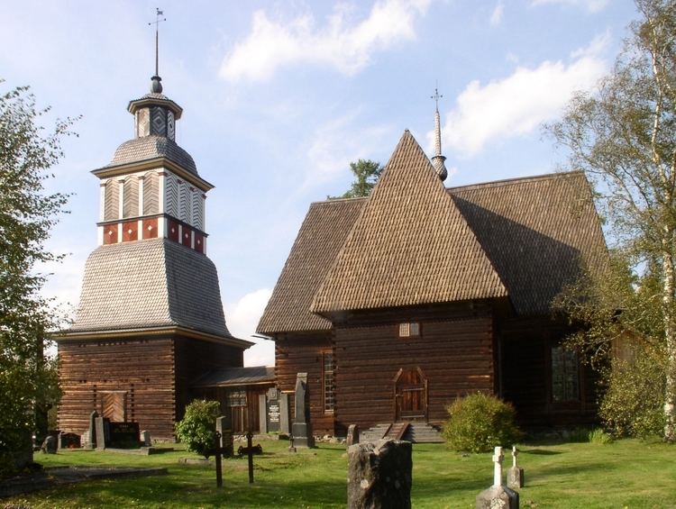
The Petäjävesi Old Church is listed as a UNESCO World Heritage Site.
Nature
There are all together 99 lakes in Petäjävesi. The biggest lakes are Jämsänvesi-Petäjävesi, Ala-Kintaus and Ylä-Kintaus. Karikkoselkä is a lake in Petäjävesi, which is formed by a meteorite.
The Karikkoselkä impact crater is located southeast of the municipal centre.