
Major islands NorthMiddleSouth Elevation 0 cm Adjacent body of water Indian Ocean | Total islands 3 Highest elevation 0 m (0 ft) Area 2 ha | |
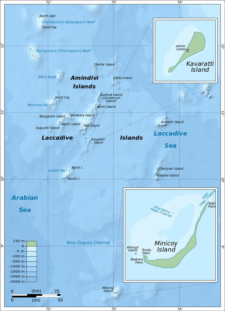 | ||
Perumal Par, also known as Peremul Par, is an uninhabited coral atoll belonging to the Amindivi Subgroup of islands of the Union Territory of Lakshadweep, India. It has a distance of 2,001 km (1,243 mi) south of the city of Delhi.
Contents
Map of Perumal Par
Geography
Perumal Par is located at 11.164°N 72.05°E / 11.164; 72.05, 33 km south of Bitra Par and 25 km to the northwest of Bangaram Atoll.
The atoll is very similar in appearance to Cherbaniani Reef further north. It has a large lagoon devoid of islands in the encircling reef, except for 3 small sandy islets located at the eastern area. The lagoons area is 83.02 km2 (32.05 sq mi). the Islands of Perumal Par are:
Ecology
Terns of different species visit this atoll. Some damage to the corals of this atoll caused by Acanthaster planci crown-of-thorns starfish was observed in the 1990s.
Its surrounding waters are a good fishing area for baitfish and the place is often visited by fishermen from inhabited islands nearby. Tourists from nearby Bangaram Island resort often make excursions to this lonely atoll.