
 | ||
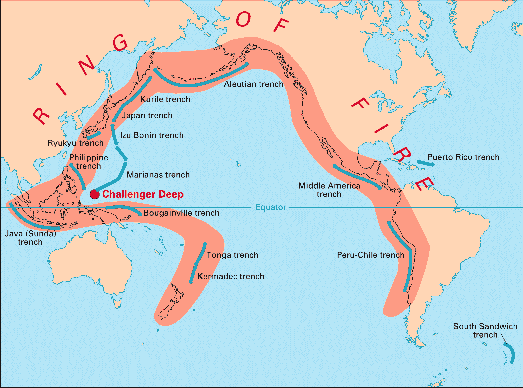
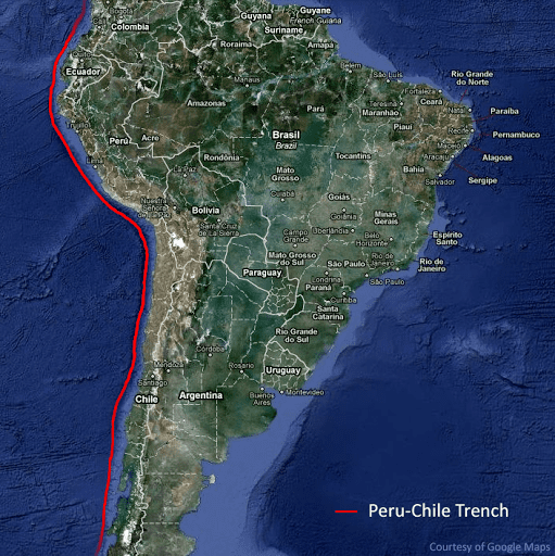
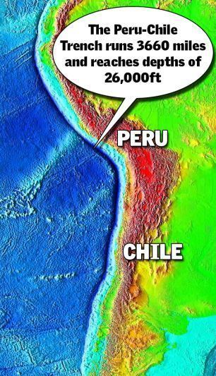
The Peru–Chile Trench, also known as the Atacama Trench, is an oceanic trench in the eastern Pacific Ocean, about 160 kilometres (100 mi) off the coast of Peru and Chile. It reaches a maximum depth of 8,065 meters (26,460 ft) below sea level in Richards Deep (23°10′45″S 71°18′41″W) and is approximately 5,900 kilometres (3,666 mi) long; its mean width is 64 kilometres (40 mi) and it covers an expanse of some 590,000 square kilometres (228,000 mi²).
Contents
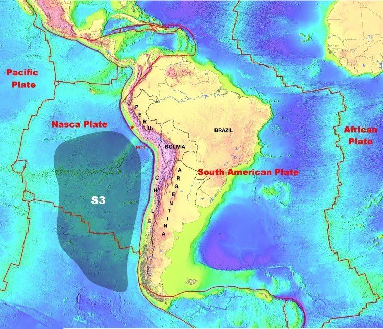
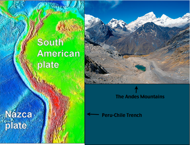
The trench delineates the boundary between the subducting Nazca Plate and the overriding South American Plate.
Geology
The trench is a result of a convergent boundary, where the eastern edge of the oceanic Nazca Plate is being subducted beneath the continental South American Plate. Two seamount ridges within the Nazca Plate enter the subduction zone along this trench: the Nazca Ridge and the Juan Fernández Ridge.
From the Chile Triple Junction to Juan Fernández Ridge the trench is filled with 2.0–2.5 km of sediments, creating a flat bottom topography. Sediments are mainly turbidites interspersed with oceanic deposits of clay, volcanic ash and siliceous ooze.
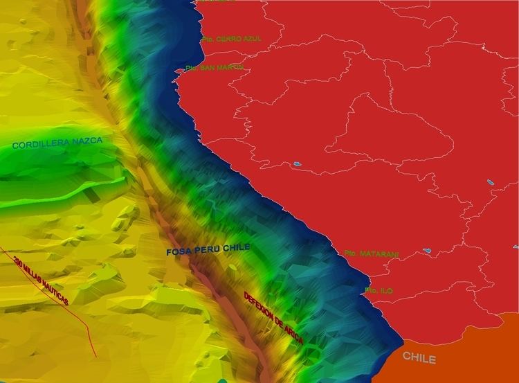
The Peru–Chile Trench, the forearc and the western edge of the central Andean plateau (Altiplano), delineate the dramatic "Bolivian Orocline" that defines the Andean slope of southern Peru, northern Chile, and Bolivia.
Oceanography
Most of the time, the trade winds drive surface waters offshore near the equator, driving the Humboldt Current from the tip of southern Chile to northern Peru. This current is associated with upwelling of deep, nutrient-rich water off the coast of Peru. El Nino disrupts the usual wind pattern and lessens the upwelling. The consequent loss of nutrient causes fish kills.
Associated seismicity
The subduction of the Nazca Plate below the South American Plate along the Chile-Peru Trench is associated with numerous earthquakes. Several of these earthquakes are notable for their size, associated tsunamis and/or landslides.