
Country United States FIPS code 19-62445 Elevation 358 m Zip code 51563 Local time Monday 9:33 AM | Time zone Central (CST) (UTC-6) GNIS feature ID 0460096 Area 122 ha Population 302 (2013) Area code 712 | |
 | ||
Weather 7°C, Wind N at 13 km/h, 92% Humidity | ||
Persia is a city in Harrison County, Iowa, United States. The population was 319 in the 2010 census, a decline from 363 in the 2000 census.
Contents
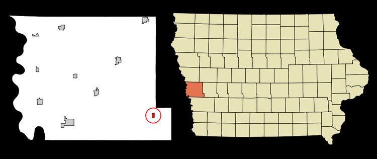
Map of Persia, IA 51563, USA
Geography
Persia is located at 41°34′44″N 95°34′14″W (41.578993, -95.570417).
According to the United States Census Bureau, the city has a total area of 0.47 square miles (1.22 km2), all of it land.
2010 census
As of the census of 2010, there were 319 people, 127 households, and 88 families residing in the city. The population density was 678.7 inhabitants per square mile (262.0/km2). There were 137 housing units at an average density of 291.5 per square mile (112.5/km2). The racial makeup of the city was 97.8% White, 0.3% African American, and 1.9% Native American. Hispanic or Latino of any race were 0.3% of the population.
There were 127 households of which 35.4% had children under the age of 18 living with them, 54.3% were married couples living together, 11.8% had a female householder with no husband present, 3.1% had a male householder with no wife present, and 30.7% were non-families. 26.0% of all households were made up of individuals and 10.3% had someone living alone who was 65 years of age or older. The average household size was 2.51 and the average family size was 3.03.
The median age in the city was 36.1 years. 27.6% of residents were under the age of 18; 7.6% were between the ages of 18 and 24; 26.9% were from 25 to 44; 22.5% were from 45 to 64; and 15.4% were 65 years of age or older. The gender makeup of the city was 48.6% male and 51.4% female.
2000 census
As of the census of 2000, there were 363 people, 141 households, and 104 families residing in the city. The population density was 794.9 people per square mile (304.7/km²). There were 145 housing units at an average density of 317.5 per square mile (121.7/km²). The racial makeup of the city was 99.45% White, 0.28% African American, and 0.28% from two or more races. Hispanic or Latino of any race were 0.55% of the population.
There were 141 households out of which 31.9% had children under the age of 18 living with them, 61.0% were married couples living together, 6.4% had a female householder with no husband present, and 26.2% were non-families. 23.4% of all households were made up of individuals and 15.6% had someone living alone who was 65 years of age or older. The average household size was 2.57 and the average family size was 2.97.
Age spread: 26.2% under the age of 18, 8.8% from 18 to 24, 27.5% from 25 to 44, 19.6% from 45 to 64, and 17.9% who were 65 years of age or older. The median age was 36 years. For every 100 females there were 92.1 males. For every 100 females age 18 and over, there were 91.4 males.
The median income for a household in the city was $36,563, and the median income for a family was $40,000. Males had a median income of $26,000 versus $22,500 for females. The per capita income for the city was $14,859. About 8.3% of families and 10.0% of the population were below the poverty line, including 13.6% of those under age 18 and 13.1% of those age 65 or over.
In the media
In September 2012, BBC Persian channel broadcast a short coverage of the city of Persia. This coverage was about the city itself and why it is named Persia. The mayor and some locals were interviewed as a part of this coverage.