
Country United States County Allegheny County Area 234 ha | State Pennsylvania City Pittsburgh Population 4,145 (2010) | |
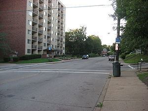 | ||
Perry South (also known as Perry Hilltop) is a neighborhood on Pittsburgh, Pennsylvania's North Side.
Contents
Map of Perry South, Pittsburgh, PA, USA
The neighborhood takes its name from Perrysville Avenue, which "was a part of the Venango trail, an Indian path leading north of 'Allegheny Town'. Commodore Perry used the Trail to carry supplies from Pittsburgh to Erie for his lake battle against the British during the War of 1812." Perrysville Avenue is an extension of Federal Street, the main north-south thoroughfare of old Allegheny City. Federal Street ends, and Perrysville Avenue begins, where the flat river plain gives way to a steep hill. Perry South is thus a hilltop neighborhood that runs along Perrysville Avenue from the river plain (on the south) to Riverview Park (on the north). The hill on which the neighborhood is built provides natural borders to the west (the Charles Street valley), to the east (the East Street valley), and to the south (Pleasant Valley).
The neighborhood was developed as a streetcar suburb, so it consists almost exclusively of residential housing, with a small business district at the intersection of Perrysville Avenue and Charles Avenue. It experienced white flight after 1960: from 1960 to 1970, the neighborhood's total population declined from 16,000 people to 13,000, while its African-American population, which had formerly been located almost exclusively in the Charles Street valley, increased from 15% to 20%. From 1970 to 2000, the total population decreased to just 5,200 people, of whom 65% were African-American. Current residents have formed the Perry Hilltop Citizens Council in an effort to prevent decay and to improve the neighborhood's business district.
The southwestern corner of the neighborhood was once called Pleasant Valley, a small area that was nevertheless once considered to be a neighborhood in its own right. A 1977 report about Pleasant Valley states that "Pleasant Valley was formerly known as Snyder's Hollow and its stream was a favorite ice skating spot. Primarily, the neighborhood was settled by Germans, Irish, Italians and Poles. Josh Gibson, Hall of Fame catcher for the Homestead Grays, a Negro National League team of the 1920s, lived there." Pleasant Valley consists of rowhouses which were built by the owners of the Pleasant Valley Street Railway - which operated the streetcars that first allowed Perry Hilltop to be developed. A series of these rowhouses, on Brightridge Street, have been listed with the National Register of Historic Places.
Surrounding Pittsburgh neighborhoods
California-Kirkbride, Central North Side, Fineview, Brightwood, Northview Heights, Observatory Hill, Spring Hill