
Seat Peren Area 2,300 km² Population 94,954 (2011) | Time zone IST (UTC+05:30) Elevation 1,445 m Founded 24 January 2004 | |
 | ||
Website | ||
Nkwareu bridge peren district nagaland
Peren (Pron:/ˈpɛɹən or pəˈɹɛn /) is the eleventh and newest district of Nagaland and has been formed by the partition of Kohima district.
Contents
- Nkwareu bridge peren district nagaland
- Map of Peren Nagaland
- History
- Geography
- Demographics
- Flora and fauna
- References
Map of Peren, Nagaland
History
The Peren district was originally a sub-division of the Kohima district. It was declared a separate district in 2003.
Geography
It is bounded by Dima Hasao and Karbi Anglong districts of Assam in the west and Dimapur district to the north-east. Kohima district in the east and Tamenglong district of Manipur in the south are the other boundaries.
It is headquartered at Peren at 1445.40 mts. above sea level. The altitude of the district varies from 800 mts. to 2500 mts. above the sea level. The principal rivers and important rivulets that flow through Peren district include Tepuiki, Mbeiki (Barak), Ntanki, Mungleu, Tesanki, Nguiki, Nkwareu, Techauki, Ngungreu, Tahaiki and Duilumreu (Tributary of Tepuiki). Mt. Paona at 2500 mts. high is the highest mountain peak in the district and third highest in Nagaland. Tening, Jalukie and Peren are the major towns of the district.
Demographics
According to the 2011 census, Peren district has a population of 94,954, roughly equal to the nation of Seychelles. This gives it a ranking of 616th in India (out of a total of 640). Peren has a sex ratio of 917 females for every 1000 males, and a literacy rate of 79%.
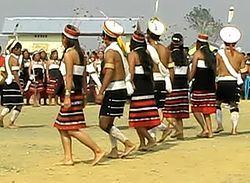
Most of the inhabitants belong to the Zeliang and Kuki tribes.
Flora and fauna
In 1993 Peren district became home to Ntangki National Park, which has an area of 202 km2 (78.0 sq mi).