
- elevation 0 ft (0 m) Basin area 32 ha Country United States of America | Length 27 km Basin area 32 ha | |
 | ||
- location Lantern Drive & CT Route 25, Monroe, Connecticut, United States - location Bridgeport, Fairfield County, Connecticut, United States Bridges Pequonnock River Railroad Bridge, East Washington Avenue Bridge, Grand Street Bridge Mouths Bridgeport Harbor Light, Long Island Sound Similar Trail View State Park, Farmington Canal Heritage, Long Island Sound, Old Mine Park Archeolo, Tallman Mountain State Park | ||
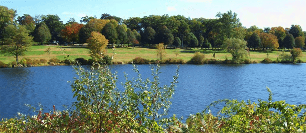
The Pequonnock River is a 16.7-mile-long (26.9 km) waterway in eastern Fairfield County, Connecticut, flowing through the city of Bridgeport. The river has a penchant for flooding, particularly in spring since the removal of a retention dam in Trumbull in the 1950s. There seems to be a sharp difference of opinion among historians as to just what the Indian word Pequonnock signifies. Some insist it meant cleared field or open ground; others are sure it meant broken ground; while a third group is certain it meant place of slaughter or place of destruction.
Contents
- Map of Pequonnock River United States
- GeographyEdit
- Crossings and navigationEdit
- Pequonnock villageEdit
- MillsEdit
- Housatonic RailroadEdit
- Historic eventsEdit
- Recreational activitiesEdit
- WatershedEdit
- Water qualityEdit
- Other uses of the word PequonnockEdit
- References
Map of Pequonnock River, United States
GeographyEdit
The eastern branch river flows southerly from Monroe through Trumbull past the Old Mine Park Archeological Site and continues to the Beardsley Zoo in Bridgeport, merging at the mouth of Bridgeport Harbor with Long Island Sound at the Bridgeport Harbor Light. The river is dammed in Bridgeport by the Bunnell's Pond Dam (41.208°N 73.187°W / 41.208; -73.187) near the Beardsley Zoo.
The western branch of the river flows southeasterly in a wide "S" pattern from near the Monroe border with Newtown, Connecticut. The two branches link in Monroe east of the intersection of Route 25 and Purdy Hill Road (41.3004°N 73.2458°W / 41.3004; -73.2458). Less than a mile south of that point in Trumbull, a tributary called North Farrars Brook joins the Pequonnock. Hedgehog Creek and Belden Brook in Trumbull flow into the river southwest of the intersection of Route 25 and Daniels Farm Road. The fourth tributary is Booth Hill Brook, also in Trumbull. It merges northeast of the Route 25 interchange with Route 15 (41.2396°N 73.1858°W / 41.2396; -73.1858). The fifth and final tributary is Island Brook, which joins the river in Bridgeport south of Bunnell Pond and north of the River Street Bridge (41.1970°N 73.1867°W / 41.1970; -73.1867). Island Brook is dammed in Bridgeport by the Forest Lake Dam. (41.220°N 73.207°W / 41.220; -73.207)
Crossings and navigationEdit
There were no bridges crossing the river until after the Revolutionary War. The first bridge opened in 1798 and led to the foundation of Bridgeport.
Bridgeport
Trumbull
Pequonnock villageEdit
Prior to the arrival of Europeans, the Pequonnock Indians of the Paugussett nation lived on the banks of the river. One village on the west bank of the Pequonnock consisted of about five or six hundred inhabitants in approximately 150 lodgings. The first English settlement on the west bank of the mouth of the Pequonnock was made in about 1665 and was called Pequonnock. This village was renamed Newfield sometime before 1777. During the American Revolution, Newfield was a center of privateering. In 1800, Newfield village was chartered as the borough of Bridgeport, forming the nucleus for the city of Bridgeport.
MillsEdit
In January 1722, Gideon and Ephraim Hawley agreed to build or rebuild a mill or mills on the stream of the Pequonnock River at the narrows by White Plain just west of White Plains Road. In the mid-18th century, Daniel Hawley built a mill "at the spring on the Pequonnock River" along White Plains Road just north of Daniels Farm Road in Trumbull Center. Daniel, who resided just northeast of the present bridge, was a grand nephew of Gideon and Ephraim Hawley and great grandson of Ephraim Hawley.
Reuben Fairchild and his brothers, Daniel and Eben built the Fairchild Paper Mill in 1826 at a place commonly called since 1674 as the "Falls" of the Pequonnock River. They were guided in their endeavors by Andrew Tait, who had learned the art of paper making in Scotland. Fairchild Paper Mill was the first mill to make white note paper. The company also ran a boarding house for its female employees. The mill stood to the west of White Plains Road near what is today the entrance to Fairchild Memorial Park.
Housatonic RailroadEdit
From 1840 to 1931, a 15-mile (24 km) segment of the Housatonic Railroad ran along much of the river with stations at Bridgeport, North Bridgeport (Lyons), Trumbull, Long Hill, Stepney, Pepper (Pepper Crossing) & Botsford, finally terminating in New Milford, Connecticut. The Railroad also maintained the Parlor Rock Amusement Park. The railroad was ripped up and replaced with Connecticut Route 8 up to Trumbull, north of which became Pequonnock River Valley State Park.
Historic eventsEdit
Recreational activitiesEdit
WatershedEdit
The Pequonnock River watershed is approximately 80 acres (320,000 m2), located at the head of the river in Monroe where it feeds the Easton Reservoir.
Water qualityEdit
The river was measured for e. coli on ten separate dates from May through September 2009. Results concluded that the river is to be considered class B (on the Connecticut Department of Environmental Protection rating system) from the watershed through Trumbull and to the entry of Bunnell Pond in Bridgeport. Areas further south on the river such as the Washington Street Bridge and into Bridgeport Harbor have considerably higher levels of e.coli and are correspondingly more polluted.