
- right Poland River Bridges Pequabuck Bridge | Basin area 151.3 km² | |
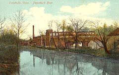 | ||
- location Farmington, Hartford County, Connecticut, United States | ||
Pequabuck river siltation2
The Pequabuck River is a river, approximately 19 miles (30.6 km) in length, which rises in Litchfield County, Connecticut and courses through neighboring Hartford County before emptying into the Farmington River in Farmington. The river has played a crucial role in the development of Plainville, Connecticut, in particular. The river's lower drainage basin consists of industrial and urban areas and effluents from these areas pollute the river's waters. The Pequabuck drove a water wheel that provided 8 horsepower to the Upper Lock Shop in Plymouth, Connecticut, a facility which would eventually become the Lewis Lock Company in 1851 and, finally, the once-renowned Eagle Lock Company. The river banks were historically the site of one of United States' first malleable iron producing units, known as Malleable Iron Works (later Andrew Terry and Company).
Contents
Map of Pequabuck River, Farmington, CT, USA
EtymologyEdit
The name "pequabuck" was derived from an indigenous Algonquin phrase meaning "clear pond" or "open pond". It is believed that this term originally referred to a pond or wetland at the headwaters of the Pequabuck River.