
Country United States County Ottawa Area code(s) 539/918 Elevation 268 m Zip code 74363 Population 134 (2013) | Time zone Central (CST) (UTC-6) FIPS code 40-58100 Area 52 ha Local time Sunday 5:06 PM | |
 | ||
Weather 19°C, Wind SE at 11 km/h, 56% Humidity | ||
Peoria is a town in Ottawa County, Oklahoma, United States. It was named for the Peoria tribe, a group of Native Americans who had moved into Indian Territory during the 19th Century.
Contents
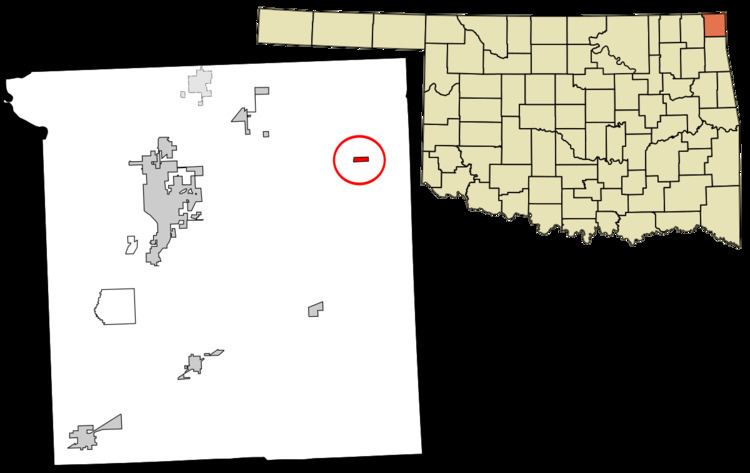
Map of Peoria, OK 74363, USA
The population was 131 at the 2010 U. S. Census, down from 141 at the 2000 census. Peoria is part of the Joplin, Missouri metropolitan area.
History
The area around Peoria has long been associated with mineral extraction The Native Americans had operated a chert quarry here since before it was visited by Europeans. Peoria began developing in 1891 as a mining camp for the area covering parts of southeast Kansas, southwest Missouri and northeast Oklahoma (then known as Indian Territory). A post office was opened in 1891 and named to honor the Peoria tribe. These lead and zinc mines were most productive between 1891 and 1896. In 1897, ore production began moving farther north in Ottawa County. William Holmes made Oklahoma's first professional archaeological study at the site in 1894. Peoria incorporated in 1898.
Peoria's population declined as mining moved out of the area. A few mines continued small scale production until the mid 1940s. The post office closed in 1941, and the Peoria school district consolidated with that of Quapaw in 1970.
Geography
Peoria is located at 36°54′54″N 94°40′13″W (36.915128, -94.670256). It is 13 miles (21 km) east of Miami, Oklahoma.
According to the United States Census Bureau, the town has a total area of 0.2 square miles (0.52 km2), all of it land.
Demographics
As of the census of 2000, there were 141 people, 54 households, and 40 families residing in the town. The population density was 582.0 people per square mile (226.8/km²). There were 59 housing units at an average density of 243.5 per square mile (94.9/km²). The racial makeup of the town was 65.96% White, 24.11% Native American, 0.71% Pacific Islander, and 9.22% from two or more races.
There were 54 households out of which 38.9% had children under the age of 18 living with them, 59.3% were married couples living together, 16.7% had a female householder with no husband present, and 24.1% were non-families. 20.4% of all households were made up of individuals and 11.1% had someone living alone who was 65 years of age or older. The average household size was 2.61 and the average family size was 3.05.
In the town, the population was spread out with 29.1% under the age of 18, 7.1% from 18 to 24, 26.2% from 25 to 44, 19.9% from 45 to 64, and 17.7% who were 65 years of age or older. The median age was 38 years. For every 100 females there were 95.8 males. For every 100 females age 18 and over, there were 104.1 males.
The median income for a household in the town was $28,125, and the median income for a family was $40,938. Males had a median income of $25,000 versus $21,250 for females. The per capita income for the town was $13,953. There were none of the families and 3.6% of the population living below the poverty line, including no under eighteens and 17.6% of those over 64.