
Existed: 1963 – present Length 3.4 km | Counties: Allegheny Constructed 1963 | |
 | ||
North end: PA 380 / Yellow Belt in Penn Hills | ||
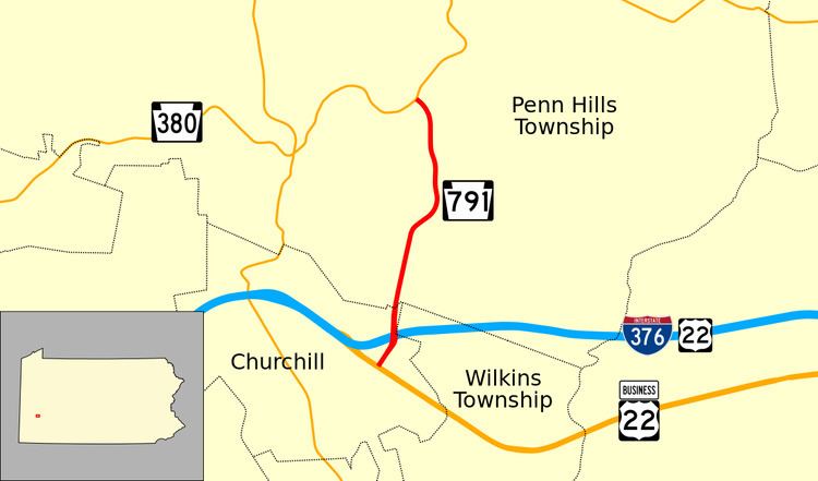
Pennsylvania Route 791 (PA 791) is a state highway located in Penn Hills, Allegheny County, Pennsylvania. It runs 2.10 miles (3.38 km) from US Route 22 Business in Churchill, Pennsylvania to PA 380 in Penn Hills, Pennsylvania. The entire route is part of the Pittsburgh Yellow Belt system of roads. The route runs through a suburban area of Pittsburgh, Pennsylvania.
Contents
Map of PA-791, Pennsylvania 15235, USA
Route description
PA 791 heads north from the southern terminus on Rodi Road, passing through suburbs. At the terminus, the road continues in both directions as US 22 Business and as part of the Yellow Belt Shortly after the intersection, it heads under Interstate 376 and receives traffic from exit 80. Two miles to the north, it ends at Pennsylvania Route 380 in Penn Hills at a shopping plaza.
History
PA 791 was originally assigned as PA 280, along with the remainder of Rodi Road from Business PA 22 to Thompson Run Road in Wilkins Township, in 1928. The route was decommissioned in 1946 and the northern segment received its current route number in 1963.
Major intersections
The entire route is in Allegheny County.