
Existed: 1928 – present Counties: Jefferson Constructed 1928 | Length 3.169 km | |
 | ||
County | ||
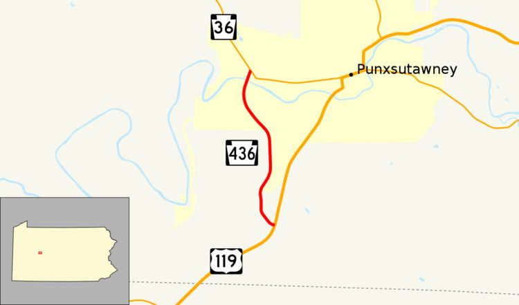
Pennsylvania Route 436 (PA 436) is a 1.969-mile-long (3.169 km) state highway located in Jefferson county in Pennsylvania. The southern terminus is at US 119 near Punxsutawney. The northern terminus is at PA 36 in Punxsutawney. PA 436 was assigned in the 1928 numbering of roads in Pennsylvania and not paved until 1932. The road's other lone major intersection on PA 436 is for Jefferson SR 3012. The route is highly elevated for most of its length, reaching as high as 1,500 feet (460 m).
Contents
Map of PA-436, Punxsutawney, PA 15767, USA
Route description
PA 436 begins at an intersection with U.S. Route 119 in Punxsutawney. The elevation of the highway is at about 1,500 feet (460 m) high. The route goes northward, parallelling US 119 for most of its length. The highway enters the borough of Sportsburg, where it intersects with Quadrant Route 3010 (Sportsburg Road). Route 3010 heads eastward, ending in a small village. PA 436 continues northward, intersecting with local roads and beginning to go down in elevation. There it enters downtown Punxsutawney and terminates at an intersection with Pennsylvania Route 36 (West Main Street).
History
PA 436 was signed along its current routing in 1928, alike most routes in Pennsylvania. The route then was not paved and this did not occur for another four years, when the road was paved in 1932.
Major intersections
The entire route is in Punxsutawney, Jefferson County.