
Counties: Greene Constructed 1961 | Length 21.66 km | |
 | ||
County | ||
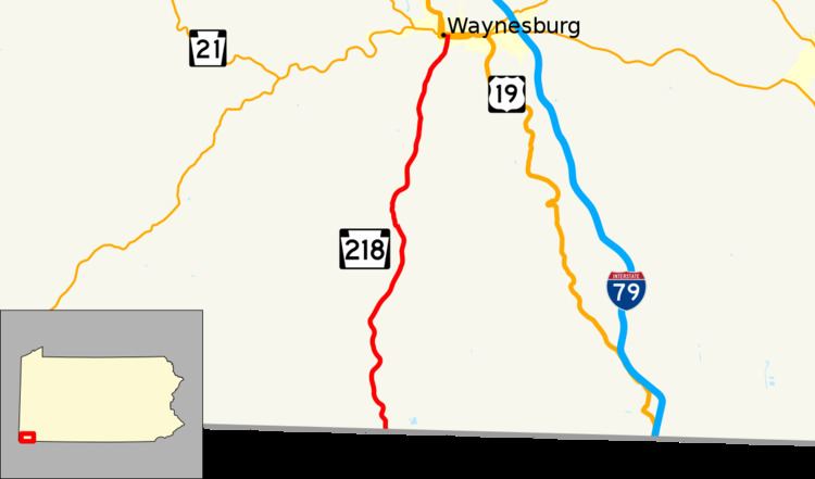
Pennsylvania Route 218 (PA 218) is a 13.5-mile-long (21.7 km) state highway located in Greene County, Pennsylvania. The southern terminus is at the West Virginia state line at Blacksville, WV. The northern terminus is at US 19/PA 21 in Waynesburg.
Contents
Map of PA-218, Pennsylvania, USA
Route description
PA 218 begins at the West Virginia border in Wayne Township, where the road continues south into that state as WV 218. From the state line, the route heads north on two-lane undivided Smith Creek Road, passing through forested areas with a few clearings and rural homes. PA 218 continues through rural areas for several miles, passing through the community of Spraggs. The route continues through more forests and heads into Franklin Township. In Franklin Township, the road continues north through woodland with some farms and residences. PA 218 reaches the community of Blairtown and crosses the South Fork Tenmile Creek into Waynesburg. Here, the road becomes South Morgan Street and crosses a Norfolk Southern railroad line, heading into residential and commercial areas. PA 218 reaches its northern terminus at an intersection with US 19/PA 21 in the commercial center of Waynesburg.
Major intersections
The entire route is in Greene County.