
Country United States Elevation 272 m Local time Sunday 4:49 AM | GNIS feature ID 0453712 Area 78.24 km² Population 1,239 (2010) | |
 | ||
Weather 10°C, Wind E at 10 km/h, 92% Humidity | ||
Penn Township is one of twelve townships in Jay County, Indiana, United States. As of the 2010 census, its population was 1,239 and it contained 569 housing units.
Contents
- Map of Penn Township IN USA
- History
- Geography
- Cities and towns
- Unincorporated towns
- Adjacent townships
- Cemeteries
- Major highways
- References
Map of Penn Township, IN, USA
History
Penn Township was named in honor of William Penn.
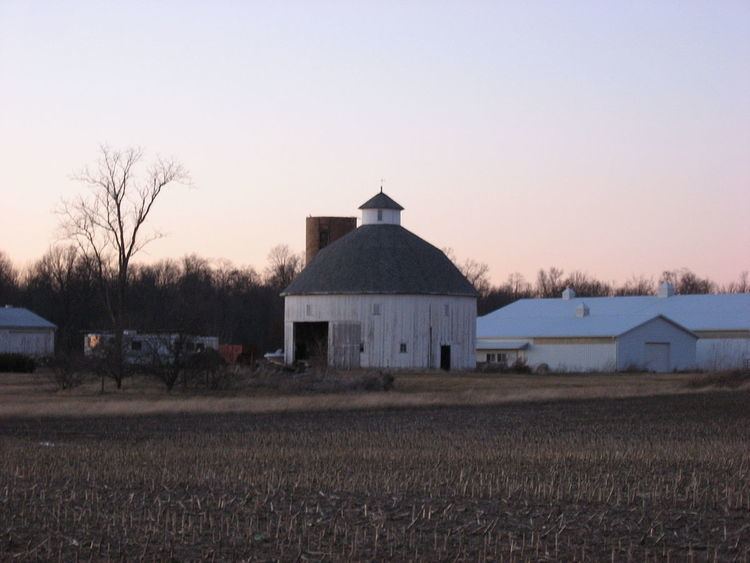
The Rebecca Rankin Round Barn was listed on the National Register of Historic Places in 1993.
Geography
According to the 2010 census, the township has a total area of 30.21 square miles (78.2 km2), of which 30.19 square miles (78.2 km2) (or 99.93%) is land and 0.02 square miles (0.052 km2) (or 0.07%) is water. The streams of Brooks Creek and Haines Creek run through this township.
Cities and towns
Unincorporated towns
Adjacent townships
Cemeteries
The township contains three cemeteries: Hillside, Maple Lawn and West Grove.
Major highways
References
Penn Township, Jay County, Indiana Wikipedia(Text) CC BY-SA