
Postcode(s) 5121 Postal code 5121 Federal division Division of Wakefield | Penfield Davoren Park Local time Sunday 3:54 PM | |
 | ||
Weather 34°C, Wind SE at 13 km/h, 28% Humidity | ||
Penfield is a northern suburb of Adelaide, South Australia in the City of Playford. The western part is mostly an industrial area wrapped around the northern sides of RAAF Base Edinburgh and south of the Max Fatchen Expressway. It includes an intermodal freight terminal on the Adelaide-Port Augusta railway line operated by SCT Logistics with a large warehouse and distribution centre operated for Treasury Wine Estates. The eastern part of Penfield is being developed for residential housing.
Contents
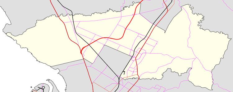
Map of Penfield SA 5121, Australia
History
The area was first settled in 1850 by William Penfield. The boundaries have varied several times before the current precise boundaries were set. A town was laid out in 1856 on section 4057. This small village at the intersection of Penfield and Argent Roads included a shop, blacksmith, school and hotel. The hotel was licensed from 1853 and closed in 1893. Land in the area was compulsorily acquired by the government in 1940 to establish a munitions factory during World War II. That intersection is now surrounded on three sides by RAAF Base Edinburgh.
The Zoar Bible Christian Church opened in 1855 north of the township. It was demolished in 1956, but the cemetery remains, near the Max Fatchen Expressway, accessed from Argent Road or the Stuart O'Grady Bikeway. Sturton Primitive Methodist Church was further south, and the building still stands in the RAAF property, visible from Stanton Road or West Avenue.
Penfield Post Office opened around 1856 and closed in 1951.