
Subregion Tâmega Area 212.2 km² | Region Norte Parishes 28 Population 72,265 (2011) | |
 | ||
Weather 8°C, Wind S at 16 km/h, 91% Humidity Points of interest Magikland, Aveleda - SA, Museu Municipal de Penafiel, Mosteiro de Paço de Sousa, Castro of Monte Mozinho | ||
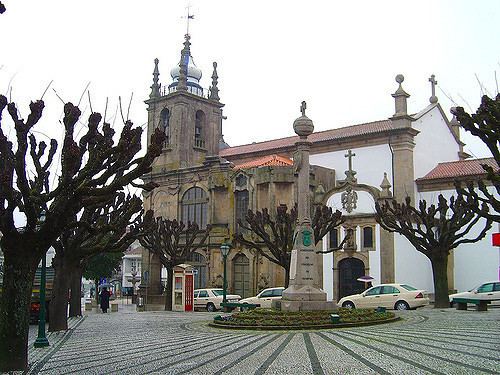
Penafiel ([pɨnɐfiˈɛɫ] [ˌpenɐfiˈɛɫ]) is a municipality and former bishopric (now a titular see) in the northern Portuguese district of Porto. Capital of the Tâmega Subregion, the population was 72,265 in 2011, in an area of 212.24 square kilometres (81.95 sq mi).
Contents
- Map of Penafiel Portugal
- History
- Ecclesiastical history
- Titular see
- Physical geography
- Human geography
- Economy
- Tourism
- Historical heritage
- Religious Architecture
- Sports
- References
Map of Penafiel, Portugal
History
The region was occupied since pre-history, as evidenced by the proliferation of megalithic monuments, stone settlements and castros. This includes the Menhir of Luzim, a 2.5 metres (8.2 ft) tall stone dating to an occupation of 3–4000 years B.C. Similarly, in the civil parish of Luzim, are the rock engravings that have existed for 3000 years. In addition, there are various rock forts (castros), subject of archaeological studies, such as the archaeological "city of the dead" in Citânia de Monte Mozinho. One of the largest in the Iberian Peninsula, it was the precursor to the Galician organized community of Cividade Gallaeci; the hill fort is dotted with traces of various cultures: Galician-Lusitanian, Roman, Visigoth and Moorish. There different legends that indicate the origins of the name Penafiel, although the common thread associates it with the many forts situated in the locality.
With the consolidation and incorporation into the Roman world, these hill forts were reorganized and moved down from the hilltops, dispersing into concentrated settlements in open areas and encircled by cultivated parcels, such as in Bouça do Ouro (Boelhe). The Roman spa town of São Vicente do Pinheiro was an example of these centres, developing around the natural resources in the region. In addition, vains of gold interspersed in the Schist and Quartzite quarries attracted Roman settlers from the empire, resulting in an intense artesnal economy, supported by the circulation of a single currency, culture and language.
In the 9th century, activity became concentrated in the Civitas Anegia on the headwaters of the Tâmega and Douro, that dominated the lands along margins of those rivers. This civitas was the precursor of Penafiel de Canas, an area that assumed an import role, but occupied a smaller area and embryonic place that concentrated on agriculture and fishing. The lands were seats of the Romanesque ecclesiastical seigneurs of the Benedictine monasteries of Paço de Sousa and Bustelo. Supporting a rich cultural influence, Paço de Sousa boasted a magnificent Romanesque architecture and gave shelter to the historian Egas Moniz Ribadouro, schoolmaster of Afonso Henriques. Other noble houses of medieval period include Barbosa de Honor (Rans), with its tower overlooking agricultural lands, or the transformed tower of Coreixas (Irivo). Romanesque religious architecture proliferated during the post-Roman period; the Romanesque temple of Boelhe or Church of São Salvador da Gândara (where they venerated a deceased saint's skull) attracted pilgrims to the region, as did the Church of Abragão, the late-Gothic Church of São Miguel da Eja or the funerary memorial of Ermida (Irivo).
During this time, emerged a new reality; in the parish of Moazares, home of the Romanesque church of Santa Luzia (circled by sculpted tombs) was a fortified settlement that developed along the banks of the rive, along the roadway from Porto and crossing the Sousa at the medieval bridge of Cepeda. This was an ideal local to build an urban community to specialize in services, artesnal commerce and sale of manufactured goods, supported by a medieval fair. The region was known as Arrifana de Sousa. Legend suggests that name came from the name Ariana (the daughter of Hermenegildo González and D. Mumadona Dias) who, following her father's death, inherited the land in the 10th century.
At its founding, it was dominated by two castles: one along the northern bank of the Sousa river, called the Castle of Aguiar de Sousa and the second along the southern margin, called Pena. It was attacked several times by Moors, but, owing to its resistance was referred to in Latin as Pennafidelis, shortened to the Castle of Penafiel.
By the 13th century, many of the plots of land were owned by Queen Mafalda.
The parish of Arrifana de Sousa was established in the sixteenth century. In the same century, in 1519, King Manuel I of Portugal granted the region a foral (charter) that raised the settlement to the status of village. Yet, its change would only occur in the reign of King D. John V (by decree on 7 October 1741).
The site was crossed by various roads, where João Correia, a rich Portoense merchant with contracts in Flanders established his home; he was a new Christian, who raised a Manueline chapel to the Holy Spirit (and who erected his bronze funerary tomb).
As it grew, Arrifana assumed the patron of São Martinho, and in the middle of the 16th century, a new Mannerist temple was constructed over the old chapel of João Correia.
The lands continued as an administrative dependency of Porto, until King D. John I conceded it a privilege for supporting his cause.
Arrifana de Sousa continued to grow as a centre of services and industry, supported by a annual fair on the feast day of São Martinho, resulting in the expansion of the urban environment to the upper elevations and the construction of the Church of the Misericórdia. Meanwhile, the nobles established their homes outside the town centre, preferring to live in their ancestral estates, established from the land rents and businesses and overseas commerce.
By law, during the reign of King Joseph (dated 3 March 1770), the place name was officially changed to Penafiel.
Ecclesiastical history
On 1 June 1770, by papal bull issued by Pope Clement XIV, the Diocese of Penafiel was established, separating it from the ecclesiastical Diocese of Porto, apparently as suffragan of the Metropolitan Archdiocese of Braga. He appointed the Carmelite Friar Inácio de São Caetano (born 1719.07.31), then-confessor of the future Queen Maria I of Portugal (then Princess of Brazil), as its first prelate. But, he would never administer the Diocese (as he was in Brazil), and was eventually convinced by the Queen to give-up the bishopric, consoled with a nominal promotion as Titular Archbishop of Thessalonica (1778.12.14 – death 1788.11.29).
On 11 November 1778, Pope Pius VI decided to extinguish the diocese, incorporating its administration (once more) into the mother Diocese of Porto, which it remains part of.
The Church of Our Lady of Mercy, which had been bombarded its cathedral, lost that status without being made co-cathedral.
Titular see
In 1969 the diocese was nominally restored as Latin Titular bishopric of Penafiel (Portuguese) / Pintien(sis) (Latin adjective).
It has had the following incumbents, mostly of the fitting Episcopal (lowest) rank, with an archiepiscopal exception :
Physical geography
The municipality extends within an area of 212.2 square kilometres (81.9 sq mi), in a confluence of river valleys marked by the Douro, Tâmega and Sousa Rivers, connecting the littoral region and the Transmontana zone. It is a landscape of deep valleys, with intense irrigated zones and pasturelands, with fields encircled by forests of pine and eucalyptus. This inter-fluvial region have granite soils and is rich in water resources, permitting intensive agriculture and extraction industries. The southwest extension of the municipality include a complex of Schist and Greywacke geology, resulting in mountainous, uncultivated and largely forest lands.
An intermediary zone, dividing the littoral and mountainous regions, the region was an important transitory point, with lines of communication extending along inter-regional, land and fluvial networks. The first example was the "royal roadways" that date to the medieval period, that connect Porto and the Trás-os-Montes, that resulted the development of the urban centre, that was a fulcrum in supporting transiting peoples and goods. The Douro was an important link and penetrated the interior, while the flanks of the Alto Douro were used to produce vineyards. The "Entre-os-Rios" district was also an important part in supporting travel along the interior.
Human geography
With 28 civil parishes it includes a resident population of 72,000 inhabitants (approximately 338.4 people per kilometre square), integrated into the Associação de Municípios do Vale do Sousa (Vale de Sousa Municipal Association)and NUTSIII Tâmega Subregion. The region is settled, but in dispersed enclaves, supported by small industry and commerce, while newer residential homes juxtaposition older rural dwellings. These older homes are usually maintained by part-time farming families and seniors, perpetuated by intense migration and facilitated by their proximity to major roadways.
The municipality is administered by the following civil parishes (freguesias):
The parishes are, largely, semi-industrialized, with a mixture of modern homes and rural dwellings in nature. Villages have houses made with small stones and granite, both of which are common in locality of Penafiel.
Economy
Extraction industries, civil construction firms and commerce employs a large number of workers, in addition to a strong concentration of service sector activities, confirmed by a Penafiel's central place in the regional economy.
Penafiel invested in new schools and renovating others during the 20th century, maintaining several kindergartens, primary and secondary schools.
The municipal council is responsible for maintaining several health centres, clinics and hospital, with Padre Américo Hospital situated in the parish of Guilhufe.
The council has has some train stations in their territory of buses throughout the country and a vast road system.
Tourism
Penafiel is the centre for therapeutic treatments and spas, highlighted by the São Vicente Spa and the Inatel Entre-os Rios Spa. The São Vicente is known for the characteristic quality of its waters: the spa is known for the hyper-mineralized waters, that include concentrated sulphurous and carbonaceous akline silicates and fluoridated water. It is considered the most alkaline among the sulphurous waters of Portugal and Europe, with temperatures of about 18.5 °C (65.3 °F), advocated for the treatment of respiratory diseases and musculo-skeletal system ailments.
One of the largest Portuguese is located in Penafiel: Magikland, formerly Bracalândia (and had moved from Braga), where it prospered.
Tourism is cyclical in the region, influence by the staggering of religious and secular activities, but marked by special events throughout the year, particularly around the religious feast of São Martinho. This includes the literary festival Escritaria and the agricultural fair Agrival, which had its basis in the traditional medieval fairs.
Historical heritage
The region of Penafiel is known for a history dating to the pre-historic period, marked by dolmens, petroglyphs, necropoli and fortified settlements constructed of stone. But, over time and through the influence of various cultural groups (Romans, Visigoths, Moors) the area began to evolve into a modern centre, marked by the evolution in its architecture from rudimentary stone dolmens to signeurial manorhouses and monumental estates.
Religious Architecture
Penafiel began building its Library in 1863. On 6 June 1917, a new Municipal Library of Penafiel was inaugurated., located on Avenue Araújo e Silva. This would close in October 1919. It was reopened to the public on June 6, 1927 and was transferred to a small lounge on Avenida Sacadura Cabral.
Sports
The most popular/practised sport within the municipality is football (soccer), leading hundreds of young people to the existing clubs. The largest club, FC Penafiel, was founded in 1951 and has regular presence on many levels of professional Portuguese seasons. During the 2014-2015 season, the club played in the Premier League after obtaining a rise from the previous season, finishing in 3rd place behind Moreirense (Champion) and FC Porto B. The club is also involved in other athletics activities winning several national and international competitions.