
Country United States Elevation 502 ft (153 m) Area code(s) 205 Zip code 35124 Population 22,289 (2013) | Time zone Central (CST) (UTC-6) FIPS code 01-58848 Local time Saturday 6:40 PM | |
 | ||
Weather 16°C, Wind SW at 10 km/h, 96% Humidity Neighborhoods Blueberry Estates, Wooddale, Silverleaf | ||
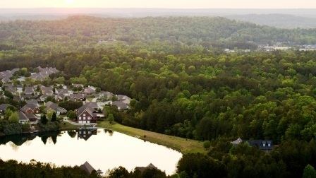
Oak mountain state park pelham alabama
Pelham is a city in Shelby County, Alabama, United States. It incorporated in July 1964. At the 2000 census the population was 14,369, but has grown to 21,352 recorded by the 2010 census. It was named for famed Confederate American Civil War officer John Pelham. An F2 tornado damaged business buildings in Pelham along with Indian Springs, Helena, and Inverness on Palm Sunday, March 27, 1994.
Contents
- Oak mountain state park pelham alabama
- Map of Pelham AL USA
- Geography
- Demographics
- 2010 census
- City government
- Notable people
- References
Map of Pelham, AL, USA
Geography
Pelham is located at 33°18′16″N 86°47′5″W (33.304581, -86.784620).
According to the U.S. Census Bureau, the city has a total area of 38.3 square miles (99 km2), 38.0 square miles (98 km2) is land and 0.3 square miles (0.78 km2) (0.89%) is water.
Oak Mountain State Park, Alabama's largest state park, is located in Pelham.
Demographics
As of the census of 2000, there were 14,369 people, 5,637 households, and 4,002 families residing in the city. The population density was 378.2 people per square mile (146.0/km²). There were 5,894 housing units at an average density of 155.1 per square mile (59.9/km²). The racial makeup of the city was 90.02% White, 3.97% Black or African American, 0.35% Native American, 1.68% Asian, 2.82% from other races, and 1.16% from two or more races. 6.42% of the population were Hispanic or Latino of any race.
There were 5,637 households out of which 35.5% had children under the age of 18 living with them, 59.3% were married couples living together, 8.9% had a female householder with no husband present, and 29.0% were non-families. 25.3% of all households were made up of individuals and 5.8% had someone living alone who was 65 years of age or older. The average household size was 2.54 and the average family size was 3.05.
In the city, the population was spread out with 25.6% under the age of 18, 7.4% from 18 to 24, 35.7% from 25 to 44, 22.7% from 45 to 64, and 8.6% who were 65 years of age or older. The median age was 35 years. For every 100 females there were 94.8 males. For every 100 females age 18 and over, there were 91.6 males.
The median income for a household in the city was $54,808, and the median income for a family was $79,794. Males had a median income of $42,659 versus $32,382 for females. The per capita income for the city was $25,611. About 3.4% of families and 4.6% of the population were below the poverty line, including 5.7% of those under age 18 and 2.4% of those age 65 or over.
2010 census
As of the census of 2010, there were 21,352 people, 8,149 households, and 5,764 families residing in the city. The population density was 561.9 people per square mile (217.0/km²). There were 8,541 housing units at an average density of 224.8 per square mile (86.8/km²). The racial makeup of the city was 81.2% White, 7.5% Black or African American, 0.3% Native American, 2.4% Asian, 6.9% from other races, and 1.6% from two or more races. 14.9% of the population were Hispanic or Latino of any race.
There were 8,149 households out of which 34.7% had children under the age of 18 living with them, 58.4% were married couples living together, 8.7% had a female householder with no husband present, and 29.3% were non-families. 24.1% of all households were made up of individuals and 6.2% had someone living alone who was 65 years of age or older. The average household size was 2.62 and the average family size was 3.14.
In the city, the population was spread out with 26.0% under the age of 18, 6.8% from 18 to 24, 32.9% from 25 to 44, 24.9% from 45 to 64, and 9.4% who were 65 years of age or older. The median age was 35.3 years. For every 100 females there were 95.0 males. For every 100 females age 18 and over, there were 96.8 males.
The median income for a household in the city was $67,622, and the median income for a family was $80,690. Males had a median income of $56,277 versus $42,269 for females. The per capita income for the city was $30,467. About 3.8% of families and 6.5% of the population were below the poverty line, including 9.1% of those under age 18 and 1.7% of those age 65 or over.
City government
The City of Pelham operates under the Mayor/Council Act. The Mayor serves as the city's chief executive and the City Council act much like a board of directors. The city also has a chief of police, fire chief, finance director / city clerk, building inspector, permits clerk, revenue director, director of golf, parks manager, waterworks superintendent, librarian, and departments thereof.