
 | ||
Old building pei ho street shamshuipo hong kong
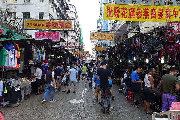
Pei Ho Street (Chinese: 北河街; pinyin: Běihé Jiē; Cantonese Yale: bak1 ho4 gaai1) is street in Sham Shui Po, New Kowloon, Hong Kong. The street is also a market and full of hawkers. The former Urban Council had built a Pei Ho Street Municipal Services Building (then known as Pei Ho Street Urban Council Complex) accommodating some stalls in old market.
Contents
Map of Pei Ho St, Hong Kong
Low economic profile and height limit of buildings on airway of former Kai Tak Airport helps Pei Ho Street to preserve buildings on the earliest planned town of Sham Shui Po in Western Kowloon. The style of Ke Lau (騎樓), balcony with two front pillars, once popular in colonial Hong Kong prior to World War II are easily found on the street.
The end of the Pei Ho Street was the former Sham Shui Po Ferry Pier. The pier was an important ferry pier from 1920s to 1970s. Thousands of commuters took ferry to Central on the Hong Kong Island.
Name
Like many other streets in adjacent, the street is named after major trading city name in China. Pei Ho is a river in northern China, collecting water from other four rivers and runs to sea near Taku fortress, the gate to protect Peking. There is also another legend that Pei Ho was the name of a little stream in Pei Ho Street, and the stream was called Pei Ho ( Literally mean stream flows to the north ). References: ( 北河街( Pei Ho Street ) ( 北河街 )