
Local time Saturday 4:31 PM | ||
 | ||
Weather 4°C, Wind S at 31 km/h, 67% Humidity | ||
Peguis first nation community consultation meeting in selkirk manitoba febuary 7 2013 mov
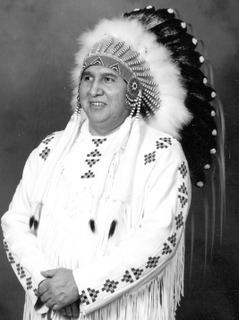
Peguis First Nation is the largest First Nations community in Manitoba, Canada, with a population of approximately 7,338 people. It is located approximately 145 kilometres north of Winnipeg. The citizens of Peguis are of Saulteaux (Anishinaabe) and Cree descent. The First Nation is named after Peguis, the chief who led the people to the lands where they settled.
Contents
- Peguis first nation community consultation meeting in selkirk manitoba febuary 7 2013 mov
- Map of Peguis MB Canada
- Peguis first nation surrender claim video 2008
- History
- Reserves
- Media
- 2009
- 2010
- 2011
- Preparation
- References
Map of Peguis, MB, Canada
Peguis first nation surrender claim video 2008
History
Chief Peguis and his Band settled in an area north of present-day Selkirk in the late 1700s. Their history is documented in journals of the Hudson's Bay Company, the Lord Selkirk settlers and the Church Missionary Society. Peguis and other chiefs signed the Selkirk Treaty in 1817. The treaty allocated land along the Red and Assiniboine Rivers to Lord Selkirk and his settlers for an annual rent of tobacco. On August 3, 1871, Peguis' son Mis-Koo-Kinew (or Henry Prince) signed Treaty 1 on behalf of the "St. Peter's Band", the name of the Peguis First Nation at the time. Treaty 1 specified that Peguis would be given 160 acres (0.65 km2) of land for each family of five people.
In 2008, Peguis First Nation announced the finalization of a land claims settlement with the Canadian federal government. The claim is for land which was surrendered near Selkirk, Manitoba in 1907.
Reserves
Peguis First Nation consists of nine reserves: Peguis 1B, Peguis 1C, Peguis 1D, Peguis 1E, Peguis 1F, Pegius 1G, Peguis 1H, Peguis 1I and St. Peters Fishing Station 1A. The reserves of Peguis total 30655.7 hectares (75749.2 acres) in area.
The largest settlement, which lies on the main reserve (1B), is also named Peguis, and is located at 51°18′15″N 97°33′50″W. The main reserve lies adjacent to the northern borders of the Rural Municipality of Fisher.
Media
The Peguis First Nation operates a First Nations community radio station, CJFN-FM 102.7.
2009
On 24 March 2009, Peguis First Nation along with Roseau River First Nation, Sioux Falls, St. Andrews, St. Clements and Selkirk MB experienced a hydrological flood. The total cost of flood in the region was CAD 40,000,000. 3,000 people were evacuated in the region. It was listed on the Canadian Disaster database.
2010
Heavy rain and high winds Interlake Region of Manitoba from 1 to 5 July 2010, caused flooding and evacuation of Peguis First Nation’s 250 residents. Approximately 300 homes on-reserve were damaged and several roads washed out. Most residents were temporarily relocated to Winnipeg and a few near Fisher River Cree Nation.
2011
By February 2011, Peguis First Nation were meeting with Aboriginal Affairs and Northern Development officials about controlling mould in the 75 homes damaged by flooding. In March 2011, as community piled sandbags in flood preparations, the Peguis First Nation's emergency measures co-ordinator, said Peguis First Nation experienced two major floods since 2009.
Preparation
In 2013, AANDC invested more than CAD$4 million to Peguis First Nation for long term flood proofing as part of a 2010 commitment to protect 75 homes.