
Architect O.B. Jacobs, et al. Area 81 ha | NRHP Reference # 08000325 Added to NRHP 25 April 2008 | |
 | ||
Location Roughly bounded by Piedmont & Peachtree Rds., GA 400 & MARTA N-S line., Atlanta, Georgia Architectural style Late 19th And 20th Century Revivals, Bungalow/Craftsman Restaurants Southern Art and Bourbon, Divan Restaurant & Hookah, Kabob Land, Blue Chip Cafe, Buckhead Diner Hotels InterConti Buckhead Atlanta, Embassy Suites by Hilton Atl, Intercon | ||
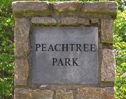
Peachtree Park is a neighborhood in the Buckhead Community of Atlanta, Georgia.
Contents
Map of Peachtree Park, Atlanta, GA, USA
It is bounded by:
Historic district
The neighborhood is roughly contiguous with the Peachtree Highlands-Peachtree Park Historic District, listed on the National Register of Historic Places.
The district is significant for a collection of architectural styles from 1921–1957 and for community planning and development. Styles include Colonial Revival, Craftsman, and English Vernacular revival.
The district was listed on April 25, 2008 (listing number 08000325) and is larger than its predecessor, the Peachtree Highlands Historic District (listed 1986), which it superseded.
Government
Peachtree Park is part of Neighborhood planning unit (NPU) B.
References
Peachtree Park Wikipedia(Text) CC BY-SA