
Settlements 15 Postal code 22410 Area 489 km² | Time zone CET (UTC+1) Area code (+381) 022 Local time Wednesday 7:35 PM Team FK Donji Srem | |
 | ||
Weather 16°C, Wind W at 8 km/h, 45% Humidity | ||
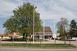
Pećinci (Serbian Cyrillic: Пећинци, [pětɕiːntsi]) is a village and municipality located in the Srem District of the autonomous province of Vojvodina, Serbi. The village has a population of 2,571 (2011), while Pećinci municipality has 19,675 inhabitants.
Contents
- Map of PeC487inci Serbia
- Name
- History
- Inhabited places
- Historical population
- Ethnic groups 2002 census
- Economy
- References
Map of Pe%C4%87inci, Serbia
Name
In Serbian, the village is known as Pećinci (Пећинци), in Croatian as Pećinci, in Hungarian as Pecsince, in German as Petschinzi, in Slovak as Pečinci, and in Rusyn as Печинци. Its name derived from the Serbian word "peć/пећ" ("furnace" in English), or "petlja/петља" ("loop" or "noose" in English).
History
The village was first time recorded by the sources in 1416. After that time, there were no other records about this settlement until 1702. The village was under Ottoman administration until the Treaty of Passarowitz (1718), when it passed to Habsburg Monarchy. During Habsburg administration, it was part of the Habsburg Military Frontier. From 1848 to 1849, the village was part of Serbian Vojvodina, but was again included into Military Frontier in 1849. After abolishment of the frontier (in 1882), it was included into Syrmia County of Croatia-Slavonia, which was an autonomous kingdom within the Kingdom of Hungary and Austria-Hungary. According to 1910 census, the village had Serb ethnic majority.
In 1918, the village first became part of the State of Slovenes, Croats and Serbs, then part of the Kingdom of Serbia, and finally part of the newly formed Kingdom of Serbs, Croats and Slovenes (later renamed to Yugoslavia). From 1918 to 1922, village was part of the Syrmia County, from 1922 to 1929 part of the Syrmia oblast, and from 1929 to 1941 part of the Danube Banovina. From 1941 to 1944, the village was occupied by the Axis Powers and was attached to Pavelić's Independent State of Croatia. Territory of present-day Pećinci municipality was an important center of partisan resistance movement and a partisan liberated territory was formed in this area during the war.
After the war, the village became part of Vojvodina, an autonomous province of the Socialist Republic of Serbia and Socialist Federative Republic of Yugoslavia. Until 1960, villages of present-day Pećinci municipality were part of the municipalities of Ruma, Stara Pazova and Zemun (village of Pećinci itself was part of Zemun municipality). A separate municipality of Pećinci was formed in 1960 and village of Pećinci was chosen for municipal center because of its favorable traffic position.
Inhabited places
Pećinci municipality includes the following villages:
Historical population
Population of the village in different censuses:
Ethnic groups (2002 census)
The population of the Pećinci municipality:
All settlements in the municipality have an ethnic Serb majority.
Economy
In 2010 Italian Bernardi Group was supposed to complete a major development project, but it was never realised.