
Website mbpp.gov.my Local time Saturday 2:36 PM | Postal code 11500 | |
 | ||
Time zone Malaysian Standard Time (UTC+8) Weather 31°C, Wind SW at 11 km/h, 72% Humidity | ||
Mtb is dangerous along paya terubong jaya penang
Paya Terubong (Penang Hokkien: long boey) is a suburb of George Town in Penang, Malaysia. It is nestled within the central valleys of Penang Island and south of Air Itam. It is also one of the most populated areas on Penang Island.
Contents
- Mtb is dangerous along paya terubong jaya penang
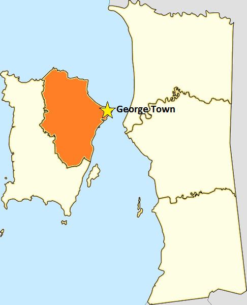
- Map of Paya Terubong Air Itam Penang Malaysia
- Etymology
- History
- References
Map of Paya Terubong, Air Itam, Penang, Malaysia
Paya Terubong first came into existence as an agricultural village. High-rise residences began to be built in the area in the 1980s, transforming Paya Terubong into a residential area.
Etymology
Paya Terubong was named after a species of grass known in Malay as terubong. Its scientific name is Cyrtococcum oxyphyllum.
History
Similar to Air Itam to the north, Paya Terubong was where agricultural farms were established, providing spices and vegetables to be traded in markets elsewhere on Penang Island. In the past, Paya Terubong Road (now Jalan Paya Terubong) was merely a hill path.
The area was only developed in the 1980s with the construction of residential high-rises to alleviate land scarcity on Penang Island. Hill slopes were cleared in the process. Initially, most of the residents worked in the Bayan Lepas Free Industrial Zone and commuted there via Jalan Paya Terubong, which is the only main road running through the area.
Among the more recent issues within Paya Terubong are the clearing of hills and daily traffic jams.