
Length 55 km | Country United States of America | |
 | ||
County New London County, Kent County Main source Worden's PondSouth Kingstown | ||
The Pawcatuck River is a river in the U.S. states of Rhode Island and Connecticut flowing approximately 34 miles (55 km). There are eight dams along the river's length. The former USS Pawcatuck (AO-108) was named after the river.
Contents
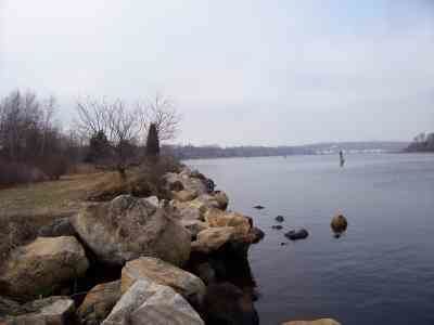
Map of Pawcatuck River, United States
History
The river was specified as the western boundary of the Rhode Island Colony in the original charter of 1636. It was formerly called the Charles River between its source and the mouth of the Wood River near Bradford, Rhode Island.
On April 20, 2006 an Atlantic white-sided dolphin swam several miles up the river to Westerly, Rhode Island from Little Narragansett Bay at the east end of Fishers Island Sound. It spent several hours at Westerly-Pawcatuck, near the bridge connecting Rhode Island and Connecticut, while several hundred spectators gathered to see it. According to authorities at the Mystic Aquarium and Institute for Exploration, the dolphin may have become separated from its pod at sea and been searching for them. It was captured and taken later that night to the aquarium, where it died; it had become sick, underweight, and bruised during its journey upriver.
The Pawcatuck River flooded during a fierce rainstorm in New England on March 29, 2010, with waters overflowing into both Westerly and Pawcatuck. Both towns evacuated low-lying areas and lost some historic buildings to flood damage, such as a 150-year-old general store in North Stonington. The bridge in downtown Westerly-Pawcatuck was closed for several weeks until the river had gone down enough for divers to inspect it for safety before it reopened.
Course
The Pawcatuck River's source is Worden's Pond in South Kingstown. It proceeds generally west and southwest through the villages of Kenyon, Carolina, and Bradford. The Pawcatuck serves as the border between the towns of Charlestown and Richmond, Charlestown and Hopkinton, and Hopkinton and Westerly in Rhode Island. It turns briefly northwest and west before resuming a southward course to flow past Potter Hill and between the towns of Westerly, Rhode Island and the Pawcatuck section of Stonington, Connecticut; its mouth is on Little Narragansett Bay on Long Island Sound (41.32°N 71.86°W / 41.32; -71.86).
Crossings
Below is a list of all crossings over the Pawcatuck River. The list starts at the headwaters and goes downstream.
Tributaries
In addition to many unnamed tributaries, the following brooks and rivers feed the Pawcatuck: