
Local time Saturday 9:12 AM | ||
 | ||
Weather 14°C, Wind SE at 27 km/h, 87% Humidity | ||
Pauatahanui (/ˈpaʊətɑːhəˌnuːi/; [ˈpaʉatahanʉi]) is a village in New Zealand's North Island. It is at the far eastern end of the Pauatahanui Inlet, an arm of the Porirua Harbour, northeast of Wellington. In local government terms, Pauatahanui is part of the Northern Ward of Porirua City.
Contents
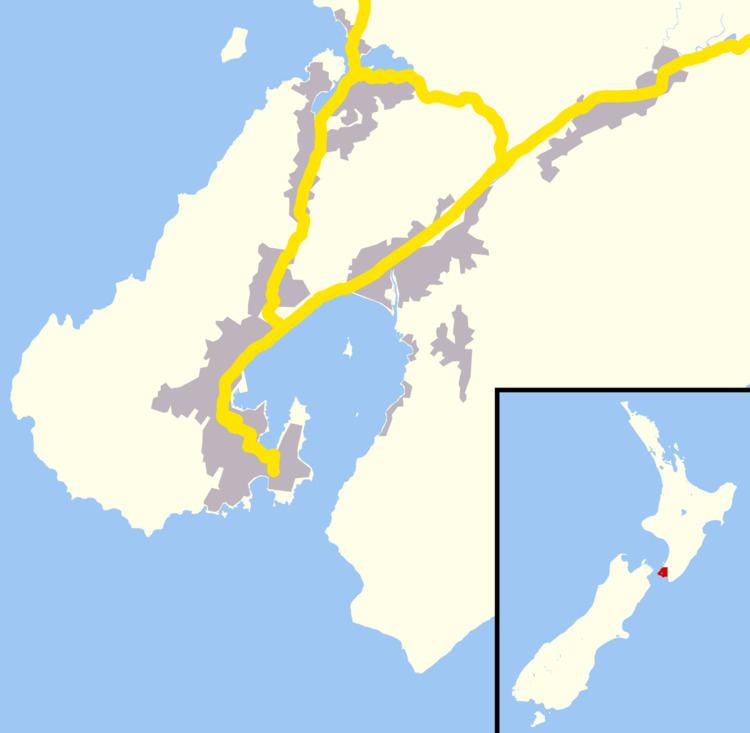
- Map of Pauatahanui Porirua 5381 New Zealand
- Early settlement and history
- Environmental preservation
- Education
- Road links
- Notable buildings
- References
Map of Pauatahanui, Porirua 5381, New Zealand
At the 2001 New Zealand census, its population (including nearby wholly rural areas) was 831: 429 males and 402 females, a 23.1% increase in population since the previous census in 1996. At the 2006 census the population was 1,080 in 360 households. At the 2013 census, 1080 people lived in the Pauatahanui area.
Early settlement and history
After Te Rangihaeata was beaten in the 1846 Hutt Valley Campaign the area became safer as a route from the Hutt Valley via Belmont and Judgeford and on to the north, via Paekakariki to the Manawatu and Wanganui. The road from Wellington reached Pauatahanui in September 1848, and a reliable road to the north as far as Paekakariki was completed by November 1849. Known nowadays as the "Paekakariki Hill Road", it continued to be the main road north until the road bridge was built at Paremata in 1939. Access from the Hutt Valley was also upgraded to a road in 1873, and the road that was to become State Highway 58 from Haywards was established in the 1870s.
The first non-denominational Protestant chapel was built about 1856, and from 1861 Anglican services were held by a visiting clergyman once a fortnight. Congregations dwindled with an Anglican church built. It became tumbledown, and was demolished around 1910. Other churches were St Joseph's Catholic Church (1878) and St Alban's Anglican Church (1898).
The first hotel was constructed in 1847 by former whalers Edward Boulton and Thomas Wilson. Burned down in 1859, it was replaced by a fourteen-room Boultons Hotel. From 1865 other hotels were the Horokiwi Hotel, the Pauatahanui Hotel, the Empire Hotel and the Junction Hotel, largely to serve the Cobb and Co stagecoach traffic. In 1912 the area went "dry" and all the hotel bars closed. In the 1911 electoral redistribution the area was transferred from the Otaki electorate to the new Wellington Suburbs and Country electorate, and no longer had William Field as a MP. The new electorate was "dry" as the precursor Wellington Suburbs electorate had already voted "dry" in the 1908 election.
A community hall was built in 1904. It was demolished in 1966 and replaced.
In World War II the US Marines had four camps in the Pauatahanui area; at Judgeford, at the Porirua side of the foot of the Haywards Hill, at Motukaraka, and in the Moonshine Valley. The Judgedford camp accommodated 3,755 men, the Moonshine camp had a recreation hall and a vehicle servicing depot, and the Haywards camp had a large theatre for the troops. Apart from a few huts for officers, most of the marines were in bell tents.
Environmental preservation
In the early 1970s the development of sections at Whitby on the south of the Pauatahanui Inlet caused noticeable silting and raised community concerns. This ultimately led to a detailed 3-year environmental study in 1975–1977, which was published as a book in 1980. Subsequently the Pauatahanui Wildlife Reserve was created, in 1984, in order to preserve the only large estuarine wetland left in the lower North Island. The wetland reserve is run by the Royal Forest and Bird Society with ongoing efforts to reduce human impact on the environment and to restore damaged areas. The reserve has several hides for viewing birdlife, boardwalks, and some barbecue / picnic areas for visitors.
Education
Pauatahanui School is notable as being one of the very few schools in New Zealand to be over 150 years old. It was established in 1855, originally in an undenominational chapel on the site of Rangihaeata's Pa, and later in the military barracks vacated by the troops. It is now increasing its pupil numbers because it serves the north-east corner of Whitby. As of July 2016, Pauatahanui School has a roll of 177 students from Years 1 to 8 (ages 5 to 12). The nearest secondary schools to Pauatahanui are Aotea College in Aotea and Porirua College in Cannons Creek, both roughly 8.5 km away.
Road links
State Highway 58 skims the southern fringe of the village: to the east it leads to Judgeford, just up the valley, and over the hills to Lower Hutt in the Hutt Valley; and to the west it travels along the southern shore of the Pauatahanui Inlet skirting Whitby and through Golden Gate to meet New Zealand's most important road, State Highway 1, at Paremata at the mouth of the Inlet.
To the north, the shortest but generally not the fastest route to Paekakariki is the Paekakariki Hill Road mentioned above, serving the fertile Horokiri Valley. Branching off that road just beyond the urban limit is Grays Road, leading to Plimmerton.
Notable buildings
Pauatahanui has a group of regionally significant 19th century buildings. They include St Alban's Church, St Joseph’s Roman Catholic Church, Thomas Hollis Stace Cottage and the Taylor-Stace Cottage.
Built in 1847, Taylor-Stace Cottage is the Wellington region's oldest surviving house, and is currently used as a beauty salon.
The former community hall (erected in 1967) was leased to a local company in 2003 and converted into the Lighthouse Cinema, the only cinema in Porirua's northeastern area.