
Location Luzon Mountain type Stratovolcano Mountain range Cordillera Central Parent range Cordillera Central | Country Philippines Elevation 1,865 m Province Mountain Province | |
 | ||
Region Cordillera Administrative Region Similar Mount Binuluan, Mount Amorong, Camiguin de Babuyanes, Latukan, Mount Makaturing | ||
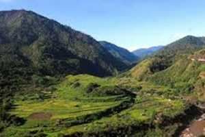
Patoc is a little studied strongly fumarolic stratovolcano in the Philippines. Patoc is located in Mountain Province, part of the Cordillera Central range, on the island of Luzon, in the Philippines. It is located 6 cadastral kilometres north of Bontoc, at latitude 17.147°N (17°8'48"N), longitude 120.98°E (120°58'48"E).
Contents
- Map of Patoc Bontoc Mountain Province Philippines
- Physical features
- Eruptions
- Geology
- Listings
- References
Map of Patoc, Bontoc, Mountain Province, Philippines
Physical features
Elevation is reported as 1865 metres above sea level (6,119 feet), and is described by the Smithsonian Institution as displaying strong fumarolic activity.
A stream and village on the west side are named Mainit (a Tagalog word for "hot"). There are hot springs at the village of Mainit, one of which has been successfully commercialised for tourists.
Eruptions
There are no reports of eruptions.
Geology
Rock type is predominantly andesite.
Listings
The Smithsonian Institution's Global Volcanism Program lists Patoc as strongly fumarolic. The Philippine Institute of Volcanology and Seismology (PHIVOLCS) has not listed Patoc or any volcanic related activity at this location.