
Country Thailand Time zone ICT (UTC+7) Geocode 3703 Population 46,100 (2005) | Seat Na Wa Postal code 37110 Area 520.8 km² Province Amnat Charoen Province | |
 | ||
Pathum Ratchawongsa (Thai: ปทุมราชวงศา, [pā.tʰūm râːt.t͡ɕʰā.wōŋ.sǎː]) is a district (amphoe) in the eastern part of Amnat Charoen Province, northeastern Thailand.
Contents
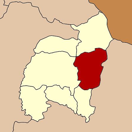
Map of Pathum Ratchawongsa District, Amnat Charoen, Thailand
Geography
Neighboring districts are (from the south clockwise) Phana, Mueang Amnat Charoen, Chanuman of Amnat Charoen Province, Khemarat, Kut Khaopun, and Trakan Phuet Phon of Ubon Ratchathani Province.
History
The district was created on 2 July 1993, consisting of the three tambon, Kham Phon, Nong Kha, and Na Wa from Chanuman District, Lue and Huai from Phana and Non Ngam from Amnat Charoen District.
Administration
The district is divided into seven sub-districts (tambon), which are further subdivided into 73 villages (muban). Na Wa Yai is a sub-district municipality (thesaban tambon) which covers parts of the tambon Na Wa and Na Pa Saeng. There are further seven tambon administrative organizations (TAO).