
Country United States City St. Louis ZIP code(s) Parts of 63111 Area 2.642 km² Area code 314 | State Missouri Wards 11 Website stlouis-mo.gov Population 2,695 (2010) | |
 | ||
Restaurants Stacked STL, The River Des Peres Yacht Clu, Carondelet Diner, Tuckers Bar & Grill, Tesson Station | ||
Patch is a neighborhood of St. Louis, Missouri. The Patch neighborhood forms the southern tip of the Carondelet neighborhood. It is defined by Robert on the north, the City Limits to the south, Alabama to the west, and by the Mississippi river to the east.
Contents
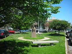
Map of Patch, St. Louis, MO, USA
Institutions
The Carondelet neighborhood has several schools located within its environs. Some of the more notable schools include Woodward School, St. Cecilia's, Blow Middle School, and St. Boniface School, though only St. Boniface is in the Patch. South Public Park is located in the Patch neighborhood. The neighborhood is home to several City churches including St. Trinity Lutheran Church, St. Boniface, Carondolet United Church of Christ.
Characteristics
This section of the Carondelet neighborhood is historic. There are Civil War era buildings in the area, National Register listed stone houses, and Sisters of the Saint Joseph's headquarters for the St. Louis Province. The area is one that is being developed with regards to business. The Carondelet Community Betterment Federation is active in the area. Commercial redevelopment activities have focused on South Broadway and the Ivory Triangle.
Demographics
In 2010 Patch's racial makeup was 71.3% White, 21.2% Black, 0.7% Native American, 1.3% Asian, 4.2% Two or More Races, and 1.4% Some Other Race. 4.0% of the people were of Hispanic or Latino origin.