Existed: 1977 – present West end: Taman Perling Length 30.4 km | History: Completed in 1979 Constructed 1977 | |
 | ||
Primarydestinations: TampoiKempasTebrauJohor JayaPlentongBandar Sri AlamMasaiPasir GudangJohor Port Kampung Pasir Puteh | ||
Progress of pasir gudang highway expansion january 2017
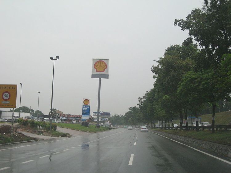
Pasir Gudang Highway, also known as Federal Route 17, is a major highway in Iskandar Malaysia, Johor, Malaysia that connects Tampoi North in the west to Pasir Gudang, Johor Port and Tanjung Langsat in the east. Pasir Gudang Highway is a four-laned highway, unlike the wider Skudai Highway which has six lanes. Many cargo trucks travel along the highway daily. Pasir Gudang Highway became the backbone of the road system linking Johor Bahru to Pasir Gudang before being surpassed by the Senai-Desaru Expressway, SDE 22, and the Johor Bahru East Coast Highway 35. There are many accidents area along the highway.
Contents
- Progress of pasir gudang highway expansion january 2017
- Map of Pasir Gudang Highway Johor Malaysia
- Pasir gudang highway nov 2014
- Route background
- History
- Features
- References
Map of Pasir Gudang Highway, Johor, Malaysia
Pasir gudang highway nov 2014
Route background
The Kilometre Zero of the Pasir Gudang Highway is located at Tampoi, Johor, at its interchange with the Skudai Highway (Federal Route 1), the main trunk road of the central of Peninsular Malaysia.
History
With the opening of the Johor Port on 1977. The new highway from Johor Bahru to Pasir Gudang was constructed. Construction of the highway began in 1977 and was completed in 1979.
Features
At most sections, the Federal Route 17 was built under the JKR R5 road standard, allowing maximum speed limit of up to 90 km/h.
There are no overlaps, alternate routes, or sections with motorcycle lanes.
On March 10, 2012, the Malaysian Prime Minister, Najib Tun Razak announced that the 15 km stretch from Tebrau to Seri Alam of the 32 km-long Pasir Gudang Highway would be upgraded from four-lane to six-lane carriageway.
