
Website www.munipasco.gob.pe Region Pasco Region | UBIGEO 1901 Area 4,759 km² | |
 | ||
The Pasco Province is one of the three provinces that make up the Pasco Region in Peru. The capital of this province is the city Cerro de Pasco.
Contents
Map of Pasco Province, Peru
Boundaries
Geography
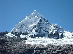
The Waqurunchu mountain range traverses the province. One of the highest mountains of the province is Waqurunchu at 5,748 m (18,858 ft). Other mountain are listed below:
Administrative division
The province has an area of 4,758.57 square kilometers (1,837.29 sq mi) and is divided into thirteen districts.
Population
The province has an approximate population of 147,126 inhabitants (2005 census).
References
Pasco Province Wikipedia(Text) CC BY-SA