
 | ||
Tony parker peak interview
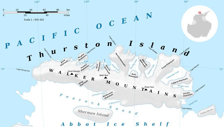
Parker Peak (72°18′S 97°24′W) is a peak of the Walker Mountains rising at the base of Evans Peninsula on Thurston Island. It was delineated from air photos taken by U.S. Navy Squadron VX-6 in January 1960. It was named by the Advisory Committee on Antarctic Names (US-ACAN) for Alton N. Parker, an aviation pilot of the Byrd Antarctic Expedition in 1928-30.
Contents
Maps
This article incorporates public domain material from the United States Geological Survey document "Parker Peak" (content from the Geographic Names Information System).
References
Parker Peak Wikipedia(Text) CC BY-SA